Article
Design and Algorithm Verification of a Gyroscope-Based Inertial Navigation System for Small-Diameter Spaces in Multilateral Horizontal Drilling Applications Tao Li 1,2, *, Gannan Yuan 1 , Haiyu Lan 1,3 and Martin Mintchev 2 Received: 29 August 2015; Accepted: 20 November 2015; Published: 9 December 2015 Academic Editor: Stefano Mariani 1 2 3
*
Marine Navigation Research Institute, College of Automation, Harbin Engineering University, No. 145 Nan Tong Street, Harbin 150001, China;
[email protected] Low Frequency Instrumentation Laboratory, Department of Electrical and Computer Engineering, University of Calgary, Calgary, AB T2N 1N4, Canada;
[email protected] Department of Geomatics Engineering, University of Calgary, Calgary, AB T2N 1N4, Canada;
[email protected] Correspondence:
[email protected]; Tel./Fax: +86-451-8251-9040
Abstract: In the recent years horizontal drilling (HD) has become increasingly important in oil and gas exploration because it can increase the production per well and can effectively rework old and marginal vertical wells. The key element of successful HD is accurate navigation of the drill bit with advanced measurement-while-drilling (MWD) tools. The size of the MWD tools is not significantly restricted in vertical wells because there is enough space for their installation in traditional well drilling, but the diameter of devices for HD must be restricted to less than 30 mm for some applications, such as lateral drilling from existing horizontal wells. Therefore, it is essential to design miniature devices for lateral HD applications. Additionally, magnetometers in traditional MWD devices are easily susceptible to complex downhole interferences, and gyroscopes have been previously suggested as the best avenue to replace magnetometers for azimuth measurements. The aim of this paper is to propose a miniature gyroscope-based MWD system which is referred to as miniature gyroscope-based while drilling (MGWD) system. A prototype of such MGWD system is proposed. The device consists of a two-axis gyroscope and a three-axis accelerometer. Miniaturization design approaches for MGWD are proposed. In addition, MGWD data collection software is designed to provide real-time data display and navigation algorithm verification. A fourth-order autoregressive (AR) model is introduced for stochastic noise modeling of the gyroscope and the accelerometer data. Zero velocity and position are injected into a Kalman filter as a system reference to update system states, which can effectively improve the state observability of the MGWD system and decrease estimation errors. Nevertheless, the azimuth of the proposed MGWD system is not observable in the Kalman filter, and reliable azimuth estimation remains a problem. Keywords: MGWD; multilateral well; horizontal drilling; MWD; Kalman filter; AR model; quasi-stationary alignment; inertial sensor
1. Introduction Horizontal directional wells offer large contact areas with oil- or gas-layered reservoirs, so horizontal directional drilling (HDD) can enhance the production and exploration rate of oil or gas. HDD technology enables successful oil or gas exploration under challenging environments, such as offshore zones, mountain areas, and even downtown places [1]. Currently, re-entry well drilling, one Micromachines 2015, 6, 1946–1970; doi:10.3390/mi6121467
www.mdpi.com/journal/micromachines
Micromachines 2015, 6, 1946–1970
2015, 6, page–page of theMicromachines HDD technologies, can revitalize old and marginal wells by intercepting its multiple vertical fractures to optimize the oil or gas yield [2,3]. Multilateral well drilling is becoming increasingly more fractures to optimize the oil or gas yield [2,3]. Multilateral well drilling is becoming increasingly more valuable in horizontal wellwell exploration, both from thethe standpoint valuable in horizontal exploration, both from standpointofofreworking reworkingexisting existing wellbores wellbores and with and respect to drilling operations [4]. Multilateral drilling to the sides of an existing horizontal with respect to drilling operations [4]. Multilateral drilling to the sides of an existing horizontal well can be regarded as a branching fromfrom the the stem ofofthe horizontaldrilling drilling naturally, well can be regarded as a branching stem themain main horizontal treetree and,and, naturally, is characterized withwith much smaller HD[5,6]. [5,6].Therefore, Therefore, significantly is characterized much smallerdiameters diameters than than traditional traditional HD significantly smaller-diameter navigation equipmentis is needed needed ininsuch applications, reaching as low 15 mm in mm smaller-diameter navigation equipment such applications, reaching asaslow as 15 diameter (Figure 1). in diameter (Figure 1).
Figure 1. Multilateral horizontal drilling bysmall-diameter small-diameter branches stemming Figure 1. Multilateral horizontal drillingisischaracterized characterized by branches stemming from from the main horizontal well trunk, thussignificantly significantly increasing oil oil well output. the main horizontal well treetree trunk, thus increasingthe theperipheral peripheral well output.
In multilateral horizontal drilling applications the navigation requirements become even more
In multilateral horizontal drilling applications the navigation requirements become even more stringent compared to traditional MWD-based horizontal directional drilling. Traditional MWD stringent traditional MWD-based horizontal Traditionalthree-axe MWD HDD HDDcompared surveyingtotools determine the roll and the pitchdirectional of the drilldrilling. bit by employing surveying tools determine the roll and the pitch of the drill bit by employing three-axe accelerometers accelerometers and the azimuth of drill bit using three-axe magnetometers [7]. However, the and the azimuth drill bitsurveying using three-axe [7]. factors: However, the precisionare of the precision of theofmagnetic sensors ismagnetometers corrupted by several (1) magnetometers susceptible to external interferences caused currents flowing(1) in the atmosphere and solar winds, to magnetic surveying sensors is corrupted byby several factors: magnetometers are susceptible which can introducecaused independent errors distorting of the MWD orientation [8]; can external interferences by currents flowingthe in calculation the atmosphere and toolset solar winds, which (2) the presence of drilling fluids and debris downhole interacts with the earth magnetic field and introduce independent errors distorting the calculation of the MWD toolset orientation [8]; (2) the further increases the azimuth error by up to 5° [9]; and (3) ferromagnetic interferences from the drill presence of drilling fluids and debris downhole interacts with the earth magnetic field and further string induce large azimuth error which˝ increases with the increase in the inclination angle and is increases the azimuth error by up to 5 [9]; and (3) ferromagnetic interferences from the drill especially significant when the well is drilled in the east/west direction [10,11]. In addition, stringrandomly-located induce large azimuth errorinwhich increases with the increase the deteriorate inclinationsurvey angle and ore deposits the vicinity of bottom-hole assembly in (BHA) is especially significant when the well is drilled in the east/west direction [10,11]. In addition, quality due to strong, but intermittent magnetic interferences. One feasible approach to avoid these randomly-located ore deposits in the bottom-hole assembly deteriorate survey magnetic interferences is to enlarge thevicinity covering of area of the non-magnetic drill(BHA) collars of the BHA [12]. quality due to non-magnetic strong, but intermittent magnetic interferences. One feasible approach avoid these However, drill collars are characterized by their high cost, heavy weight, andto relatively weakinterferences fracture, which to failure.area Gyroscope-based Inertial Navigation Systems magnetic isistousually enlargeprone the covering of the non-magnetic drill collars of the (INS) BHA [12]. can continuously provide position, velocity, and attitude of objects, such as submarines, airplanes, However, non-magnetic drill collars are characterized by their high cost, heavy weight, and relatively automobiles, etc., relative initial point by a combination of Navigation gyroscopes and weakrockets, fracture, which is usually proneto toanfailure. Gyroscope-based Inertial Systems accelerometers [13]. Such systems can serve as an alternative to magnetometer-based surveying in (INS) can continuously provide position, velocity, and attitude of objects, such as submarines, downhole MWD. Since such INS is a type of dead-reckoning system which needs to integrate the airplanes, rockets, automobiles, etc., relative to an initial point by a combination of gyroscopes and outputs of inertial sensors for the calculation of orientation and position, INS is characterized by accelerometers [13].accuracy Such systems can serve an alternative magnetometer-based surveying in short-term high and long-term errorasaccumulation [14].toEven high-accuracy INS operating downhole MWD. Since INS is a5000 typeft.ofposition dead-reckoning system needs to and integrate in an unaided mode such may produce error per hour due which to sensor’s error bias the outputs of inertial[15]. sensors for the calculation position, INSadditionally is characterized accumulation Moreover, stochastic noiseofatorientation the output and of the gyroscopes and by short-term high accuracy andthe long-term accumulation [14]. Even INS operating significantly deteriorates accuracyerror of this orientation solution, so high-accuracy building an appropriate error model is pivotal the quest to improve thedue overall quality oferror this and in angyroscope unaided stochastic mode may produce 5000 ft. in position error per hour to sensor’s navigation solution. In addition, it has to be noted that MWD systems, in particular, operate in very bias accumulation [15]. Moreover, stochastic noise at the output of the gyroscopes additionally and significantly deteriorates the accuracy of this2 orientation solution, so building an appropriate
1947
Micromachines 2015, 6, 1946–1970
gyroscope stochastic error model is pivotal in the quest to improve the overall quality of this navigation solution. In addition, it has to be noted that MWD systems, in particular, operate in very harsh downhole environments, making the utilization of gyroscopes downhole even more difficult, because their stochastic noise characteristics are not stable at different and dynamically changing temperatures and vibrations. However, advances in contemporary micro-electro-mechanical system (MEMS) technology enables the manufacturing of new generations of gyroscopes of smaller size, with excellent vibration immunity combined with high-temperature tolerance. Gyroscopic multiple shot was firstly described in [16] which provided a series of photographic images showing the inclination and the direction of a well, but the measurements were not in real-time. Fiber optic gyroscope-based MWD surveying tool was proposed in [17], which was used to monitor the BHA’s azimuth. A drilling BHA with a small-diameter rate gyroscope was deployed in [18] to reduce borehole position uncertainty under the influence of disturbing magnetic environments and near metal casings. The susceptibility of MEMS gyroscopes to shocks and vibrations was successfully tested in harsh downhole environments and a wavelet-denoising method was used to enhance the azimuth accuracy of the BHA [19]. A MEMS gyroscope guidance system was designed for ultra-deep-water applications to shorten the drilling response time and to decrease magnetic impact [20]. Nevertheless, BHA navigation errors caused by the bias in MEMS gyroscopes are greatly increased in harsh environments if compensatory external adjusting is lacking. Zero velocity update (ZUPT) alignment has been introduced to compensate for MEMS errors [21] and this method limited the position error to 40 m during 90 min navigation with a Litton LTN90-100 inertial measurement unit. However, ZUPT alignment is time consuming and is useless for azimuth estimation [22]. Velocity matching alignment merges velocity measurements from GPS to Kalman filtering to estimate the orientation of objects [23]. The prerequisite to use this method is the availability of a GPS signal, but the radio signals cannot reach downhole. Therefore, In-drilling Alignment (IDA) was proposed to constrain the azimuth error which was estimated to be 25 times smaller than the error restriction in traditional magnetometer-based surveying [24,25]. Rotary-In-Drilling Alignment (R-IDA), a reduced version of the IDA, was recently proposed to minimize INS dynamic position and azimuth errors. In R-IDA, the BHA was installed on a rotating platform controlled by a stepper motor in the north-east plane associated with the azimuth angle [26]. However, IDA and R-IDA associated devices cannot be directly utilized in lateral HDD applications because of size limitations. This paper presents the design and algorithm verification of a MGWD device for lateral HDD applications. The design requirements were defined as follows: ‚ ‚
‚ ‚
The attitude error of the device should be less than 0.1˝ and the position error should be less than 1 m for 1000 m-deep wells. The device installs in a steel tube of 24-mm maximal diameter and the size of the three-dimensional device should be less than 150 mm ˆ 150 mm ˆ 10 mm (length, width and height). The temperature range of the device should be between 40 and 100 ˝ C. The device should be able to perform well in a shock and vibration environment ranging up to 15 g RMS (5–500 Hz).
In order to meet the above design requirements, small-diameter and high temperature sensors were selected. Custom software was designed for MGWD data collection and algorithm implementation. The Allan variance method was utilized to test the error characteristics of all sensors in the designed MGWD system. The results from the autocorrelation function calculation for the gyroscopes and the accelerometers showed that the stochastic noise of the sensors cannot be simply modeled with the Gauss-Markov model, so a fourth-order autoregressive (AR) model was employed for the stochastic noise modeling of the sensors. The alignment method of the MGWD device utilized zero velocity together with zero position update and accurate Kalman filter state space equation was 1948
Micromachines 2015, 6, 1946–1970
built in terms of the system dynamics for fine alignment. In addition, this paper discusses system stability and state observability of the developed laboratory model.
Micromachines 2015, 6, page–page
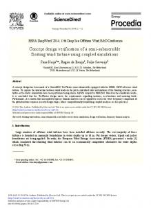
2. 2. Fundamental FundamentalTheory Theoryof ofMiniature MiniatureGyroscope-Based Gyroscope-BasedWhile WhileDrilling Drilling(MGWD) (MGWD)System System 2.1. 2.1. Definition Definition of of Coordinate Coordinate Frames Frames Body axis aligned aligned with with roll, roll, pitch, pitch, and and azimuth azimuth of of the the objects objects [27]. [27]. The Body frame frame is is an an orthogonal orthogonal axis The MGWD system in in this this paper paper uses usesright, right,forward, forward,and andup updirection directionasasthethe body frame indicated MGWD system body frame indicated in in Figure 2. Figure 2.
Z
Y X Figure Figure 2. 2. Definition Definition of of SCC1300-D04 SCC1300-D04 body body frame. frame.
SCC1300-D04 SCC1300-D04 (Murata (Murata Electronic Electronic Inc., Inc., College College Station, Station, PA, PA, USA) USA) is is aa combined combined gyroscope gyroscope (X-axis) and three-axis accelerometer component [28], which main characteristics are shown Table in 1. (X-axis) and three-axis accelerometer component [28], which main characteristics are in shown Table 1. Table 1. SCC1300-D04 Performance. Table 1. SCC1300-D04 Performance.
Parameters Gyroscope Parameters Offset Short Term Parameters Instability