2010 IEEE International Conference on Robotics and Automation Anchorage Convention District May 3-8, 2010, Anchorage, Alaska, USA
Visual Path Following on a Manifold in Unstructured Three-Dimensional Terrain Paul Furgale∗ and Tim Barfoot† University of Toronto Institute for Aerospace Studies Toronto, Ontario, Canada, M3H 5T6
∗
[email protected], †
[email protected]
Abstract— This paper describes the design and testing of a technique to enable long-range autonomous navigation using a stereo camera as the only sensor. During a learning phase, the rover is piloted along a route capturing stereo images. The images are processed into a manifold map of topologicallyconnected submaps that may be used for localization during an autonomous repeat traverse. Path following in non-planar terrain is handled by moving from localization in three dimensions, to path following in two dimensions using a local ground plane associated with each submap. The use of small submaps decouples the computational complexity of route repeating from the length of the path. We validate the algorithm by demonstrating its performance on a difficult three-dimensional route. Using this technique, a rover may autonomously traverse a multi-kilometer route in unstructured, three-dimensional terrain, without an accurate global reconstruction.
Fig. 1. The six-wheeled rover platform used in our visual path-following experiments. The stereo camera used for localization and mapping was a Point Grey Research Bumblebee XB3.
I. I NTRODUCTION In environments lacking a Global Positioning System (GPS) or equivalent, long-range autonomous navigation for rovers becomes a very difficult problem. Relative localization systems based on some combination of visual, inertial, and odometric sensing have become increasingly accurate. However, regardless of the level of accuracy, the error in the position estimate for any of these methods will grow without bound as the rover travels, unless periodic global corrections are made. Manifold mapping has been used to enable autonomous robot mapping and localization in planar environments [1], [2], [3]. Embedding a robot’s path in a higher-dimensional space allows for mapping without internal inconsistencies resulting from drift in motion estimates. Extending this idea to three-dimensional mapping results in a hybrid topological/metric representation [4]. We have developed a complete system for long-range, autonomous operation of a mobile robot (Figure 1) in outdoor, unstructured environments. This is achieved using only a stereo camera for sensing, a teach-and-repeat operational strategy, and a manifold map. During a learning phase— the teach pass—the rover is piloted over the desired route (either manually or using some external autonomous system), while the localization system builds a series of overlapping submaps. These submaps are then used for localization during the autonomous traversal phase—the repeat pass. The contribution of this paper is to outline a method suitable for long-range navigation in unstructured, three-dimensional
978-1-4244-5040-4/10/$26.00 ©2010 IEEE
terrain. Furthermore, we evaluate this method on a route with significant non-planar camera motion. While [5] evaluates the three-dimensional localization system in detail, this paper describes the hybrid topological/metric path representation we developed to bring path following on a manifold out of the plane and into unstructured, three-dimensional environments. II. R ELATED W ORKS In an early paper on vision-based map building, Brooks [6] outlined some basic principles for robotic mapping: • The world is inherently three-dimensional. Localization and mapping should reflect this. • Uncertainty in sensing will lead to maps that are globally inconsistent. However, to enable robot autonomy, maps only need to be locally consistent. To deal with this, he proposed a map composed of freespace primitives in a graph. Similar in concept, [2] designed and implemented a multi-agent system that represented the robot’s map as a manifold embedded in a higher-dimensional space. Manifold mapping changes the way a map represents the world. A map becomes topological in the sense that it defines a sequence of connected spaces, but the spaces in the map may have a many-to-one correspondence with the world. This topology is represented by dividing the map into a graph of submaps [7], [2], [3], or using a continuous relative representation [4]. Incremental errors that would cause inconsistencies in a purely metric map
534
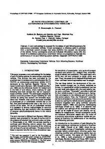
disappear within the manifold representation. As a result, loop-closing decisions may be delayed [2] and loops may be closed in constant time, regardless of the size of the map [4]. Manifold mapping removes the constraint that maps be globally consistent, but in order to be useful for localization, the neighborhood around the robot must still appear locally Euclidean. To see where this constraint expresses itself in the SLAM problem we examine the structure of the basic SLAM equations. The SLAM problem is formulated probabilistically as the task of estimating the joint posterior density of the map, m, and vehicle state at time k, vk , given all previous measurements, z0:k , control inputs, u0:k , and prior knowledge, x0 [8]: p(xk , m|z0:k , u0:k , x0 ) (1) Most solutions to this problem involve computing p(zk |xk , m), the likelihood of the measurement vector, zk , given the current state and map estimates. The likelihood is then expressed using an observation model, h(·), such that zk = h(xk , m) + vk , (2) where vk is observation noise. The properties of (2) determine the form of the constraint. Most navigation sensors discern something about the geometry in the robot’s local neighborhood and, for a map to be useful, the neighborhood must appear Euclidean to the sensor suite. Any deviation must be small enough to hide in vk . This is the motivation behind the adaptive window selection in [4], and the choice of submap size in [3]. If this constraint is satisfied, the map is still useful for localization, even if the global reconstruction is very inaccurate. Visual teach-and-repeat navigation systems have been built on this very concept, using topologically-connected keyframes and a path-tracking system that attempts to drive the robot to the same viewpoints along the path. These algorithms may be classified as appearance-based, which correlate large portions of the input image with the keyframes [9][10], and feature-based, which track sparse feature points found in the keyframes [11][12][13]. Appearancebased systems generally require planar camera motion, so only feature-based algorithms are suitable for localization in three-dimensional environments. Royer et al. [11] use a global bundle adjustment to create a consistent map whereas ˇ similar path-following performance is reported by Segvi´ c et al. [12] who use only local reconstructions and a simple visual servoing scheme. These results suggest that large-scale autonomy is possible without a globally-consistent reconstruction. However, none of the teach-and-repeat algorithms published to date have been tested in unstructured, highly three-dimensional environments. III. S YSTEM D ESCRIPTION We have developed a complete system for mapping and localization using a stereo camera as the only sensor. The major processing blocks of our system are depicted in Figure 2.
!"#$%&'()"%"$' *+,-"('
4)"%"$'5",)1%"' "6)%,#7$3'
.,/'01*2&*3-'
.,/'&,),0,("'
?",#='/,(('
8$#,2'+,/'5",)1%"('
8$#,2*9,7$3' C,/)1%"'()"%"$' *+,-"'
Fig. 2.
BA'%"5"%"3#"'/,)='
4)"%"$'5",)1%"' "6)%,#7$3' :*(1,2' $&$+")%;'
!"/",)'/,(('
8$#,2' +,/('
@A'/$("'
!$1)"'' +,3,-"%''
BA'/$("'