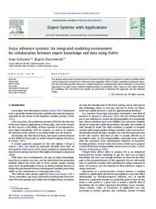
Ecocity World Summit 2009 Proceedings
GIS INFRASTRUCTURE INTERDEPENDENCY MODELLING WITH FUZZY INFERENCE SYSTEMS (FIS) FOR PREDICTING THE DISTRIBUTION OF ECONOMIC OPPORTUNITIES Arif Wismadi12, Mark Brussel2, Heru Sutomo1, Prof. Dr. Ir. M.F.A.M. van Maarseveen2 1) Master of Science Program in Management of Infrastructure and Community Development, Graduate School of Universitas Gadjah Mada, Jl Teknika Utara, Yogyakarta, Indonesia Phone +62 2747467022, Fax: +622746491076,
[email protected],
[email protected], http://pipm.pasca.ugm.ac.id 2) ITC International Institute for Geo-Information Science and Earth Observation, Hengelosestraat 99, P.O. Box 6, 7500 AA Enschede, The Netherlands, http://www.itc.nl ABSTRACT The level of performance and spatial pattern of infrastructure networks are among the most determining factors of urban and regional growth. They determine spatial distribution of economic opportunities and the attractiveness of a location for people to live in. This paper presents a new method for Geographical Information System (GIS) based modelling of infrastructure interdependency for predicting the distribution of economic opportunities in a region. The method aims to help planner and policy maker for better directing and managing the growth of the development. We implemented Sugeno Fuzzy Inference Systems (FIS) model. In the model, we applied two types of algorithm. The first was an ordinary-least-squares (OLS) algorithm without including neighbourhood data. The second was an OLS with the inclusion of neighborhood data (spatially lagged explanatory and response variables). We determined parameters of FIS models with network analysis approach called the NETS (network enabling transport system). To qualify the outcomes of integrated infrastructure, we used three classes of opportunity to economic activities. Those are ‘basic services’, ‘domestic activities’, and ‘income generating activities’. We validated distribution of economic opportunities as predicted by the FIS models with the distribution of actual economic activities in the region. The comparison of the performances of FIS models reveals that Sugeno FIS model trained by the rule-based spatial-lag OLS algorithm provides the best result. Keywords: - Infrastructure Interdependency, Sugeno, Fuzzy Inference Systems, Economic Opportunity, Spatial Lag OLS
INTRODUCTION The relationship between infrastructure network and spatial distribution of the development is commonly recognized in urban and regional planning practices. However, the role of each type of infrastructures as part of an integrated system and the nature of its integration is not widely known. The knowledge of relationship between infrastructures as integrated systems and its impact to the spatial distribution of economic opportunities in a region is necessary to help planner and policy maker for better directing and managing the growth of the development. Some researchers [1,2,3] have attempted to develop modelling and simulation for evaluating infrastructure as integrated systems. However, the knowledge in this field is relatively immature. Besides, those limited knowledge on infrastructure integration are mostly focused on the analysis of infrastructure interdependency with specific aim to vulnerability analysis. The backgrounds of those studies commonly relate to infrastructure disruption due to terrorism, malfunctioning of critical infrastructure or natural disaster. Therefore, it mainly concerns on measuring the vulnerability or ‘the decreasing infrastructure performance’ due to perturbation from other infrastructure. Even thought the knowledge is useful for maintaining continuous function of infrastructure, it is insufficient to support directly to infrastructure and
1
Ecocity World Summit 2009 Proceedings
spatial planning practices. To provide proper planning method toward efficient infrastructure investment to support regional economic development, the deeper knowledge on integrated infrastructure system, other than only vulnerability focus, is important to be established. For addressing this issue, we offer new approach for the infrastructures integration analysis. In this approach, the integration analysis still refers on interdependency analysis. However, it focuses on the attempt to ‘increasing the infrastructure performance’. Hence, the analysis for the interdependency aimed to take into account the performance of other infrastructures to support the intended function of the infrastructure systems. The establishment of this method is important for providing spatial planning tool for infrastructure and spatial development in effective and efficient manner. By knowing the nature of integrated infrastructure and its role on providing opportunities to economic activities, the investment of infrastructure, regarding both allocation and location, can be more optimized. Furthermore, it also enables us to better manage infrastructure development for directing the growth of a city or region.
Problem Formulation To quantify and qualify integrated level of infrastructures, and the degree of opportunity to economic activity, we employed fuzzy set theory. The idea of a fuzzy set is quite simple. Fuzzy set are classes within which the transition from membership to non-membership take place gradually rather than suddenly. Since the degree of opportunity to economic activity also increases gradually as the result of a variety of interdependency between different types of infrastructure, the fuzzy set theory is relevant for this research. Among limited study for understanding and modeling interdependency for vulnerability analysis, one of the previous work [4] implemented fuzzy set theory to vulnerability analysis and represent relationship between infrastructure networks in term of relative importance of infrastructures. Relevant with fuzzy set theory, three types of fuzzy inference systems (FISs), Mamdani FIS, Sugeno FIS, and Tsukamoto FIS model, are available. The differences between those FISs lie in the consequents of their fuzzy rules, and thus their aggregation and defuzzification procedures differ accordingly. In general, the Mamdani FIS is implemented by synthesizing a set of linguistic control rules obtained from experienced human operators (policy makers or experts) [5]. Therefore, it is more intuitive and well suited to human input. However, it requires assumption on the availability of expert in the subject and it potentially includes subjectivity on fuzzy rule composition. Tsukamoto FIS applies monotonic type of fuzzy set to avoid the time consuming process of defuzzification. However, it is not used often since it is not as transparent as either the Mamdani or Sugeno fuzzy models [6]. The Sugeno FIS reduces the subjectivity by putting into operation a set of input-output equation to predict the interdependency between variables. Therefore, it is computationally efficient and well suited with mathematical analysis. The Sugeno FIS also work well with linear technique and optimization and adaptive technique [7]. Hence, we selected the Sugeno FIS for the integrated infrastructure analysis. The characteristic of Sugeno FIS enables us for performing simulation to obtain optimum location-allocation infrastructure investment. However, currently, with limited mathematical formulation to model the interdependency between infrastructures, it is difficult to implement Sugeno FIS. Fortunately, it is widely known that regression techniques can be applied to obtain a mathematical model. In fact, linear regression modeling such as ordinary-least-squares algorithm (OLS) is commonly applicable to predict level of interdependency between multi-variables. However, for this research, since we implemented GIS modeling which has spatial feature to be considered in the analysis, such as location, shape, and size of the unit of analysis, the implementation of conventional OLS in this interdependency analysis is questionable. A problem using conventional regression modelling is on the assumption that the data are statistically and spatially independent. As a matter fact, spatial relationships between people as well as the nature of infrastructure services, have a tendency to be dependent. This phenomenon is known as spatial autocorrelation. The general explanation of this phenomenon is the fact that values over distance are more similar or less similar than expected for randomly associated pairs of observations [8].
2
Ecocity World Summit 2009 Proceedings
To overcome this issue, a mixed regressive–spatial autoregressive models, which incorporate both regression and spatial autocorrelation might be applied [8,9]. The mixed regressive–spatial autoregressive model is statistically sound in the presence of spatially dependent data, in contrast with the standard linear model that is not. This method enables us to incorporate spatial interactions caused by unknown spatial processes such market effects that cannot be captured by the independent variables [8]. It is also known as Spatial-Lag OLS. The consequence of including OLS for Sugeno FIS Model is a requirement to develop rule-based OLS as the input in the equation. This approach is theoretically able to provide better prediction since many different set of interdependency between different levels of infrastructure may produce different impacts. For example, a region with low electricity and low telecommunication (low-low) supply might more sensitive to new infrastructure investment than a region with (high-high) electricity and telecommunication supply. To investigate this premise, the reliability of this extended rule-based OLS, with specific application for fuzzy set theory in a GIS environment, should be investigated before implemented for planning practice. In this paper, therefore, we developed and compared different sets of algorithm in the GIS Simulation to estimate and predict the distribution of economic opportunities due to infrastructure development. The first set was a conservative ordinary-least-square algorithm (OLS) applied without Sugeno FIS model. The second was OLS implemented in with taking into account all the possible rules required in Sugeno FIS model (Rule-Based OLS). For both sets, we applied two types of OLS. The first was ordinary-least-squares algorithm (OLS) without including neighbourhood data. The second was OLS with the inclusion of neighbourhood response data (spatially lagged response variable).
MATERIAL AND METHOD Study Design In general the purpose of the research aims for predicting the distribution of economic opportunities in a region. Therefore, in this research, we were not measuring the output of infrastructure investment (physical networks) other than we measured the outcome of infrastructure (level of service) in the simulation. With respect to implement this research idea, we developed the architecture of Sugeno FIS [5] through five steps of investigations. First, to identifying parameters for FIS models we explored the approach of NETS (Network Enable Transport System) [10], which originally applied for integrated analysis of transport and telecommunication infrastructures. Second, we evaluated infrastructure independency and interdependency concept from previous works to better understanding the structure of the problems. Third, to develop proper modelling and simulation environment we investigated modelling characteristics, especially related with the GIS and spatial analytical environment. Fourth, we elaborated Sugeno FIS model by means developing input-output algorithm for Sugeno FIS with linear regression modelling. Fifth, we predict the level and distribution of economic opportunity in the region with each algorithm. Finally, we validated distribution of economic opportunities as predicted by the FIS models with the distribution of actual economic activities in the region. In this step, to find the best algorithm, we compared the predicted result from a conservative ordinary-least-square algorithm (OLS) with the OLS implemented in Sugeno FIS model. For a comparison, both sets, OLS with and without spatial-lag were evaluated.
Identifying parameters for FIS models We determined the parameters of FIS models based on a network analysis approach using the NETS (network enabling transport system) [10]. Instead of focusing on ‘networks systems’, the ‘NETS’ offers wider overviews on ‘systems networks’, or networks of various interdependent systems. Those systems networks in the NETS consist of three actual systems networks (infrastructure-fix facilities, traffic-floating nodes, auxiliary service to support other systems) and three abstract systems networks (regulatory, communication, and skill) to support function and utilization of the systems. With an exception to communication networks, we focused on actual system network for the analysis. These selected networks determined the indicator for infrastructure performance as the variables for analysis.
3
Ecocity World Summit 2009 Proceedings
Dependency and interdependency concepts Infrastructure interdependency can be classified into Physical, Cyber, Logical and Geographic [1] or Physical, Informational, Geospatial, Policy and Societal [2]. Physical or Input-Output Interdependency refers to linkage between input and outputs of two agents: a commodity produced or modified by one infrastructure (an output) is required by another infrastructure to operate (an input) [1] or engineering reliance between component (e.g information system rely on electricity) [2]. Infrastructures have Cyber or Informational Interdependency if its state depends on information transmitted through the information infrastructure. For example, the reliable operation of modern infrastructures depends on computerized control systems. Infrastructures have Geographic or Geospatial Interdependency if a local environment event can create state changes in all of them. A geographical interdependency occurs when elements of multiple infrastructures are in close spatial proximity. Logical Interdependency is an interdependency mechanism that is not via physical, cyber or geographic connection [1]. It includes policy/procedural interdependency and societal interdependency [2]. To reduce the complexity of the model, we exclude logical interdependency in the analysis. Hence, the types of interdependency included in the analysis were physical, informational, and geo-spatial.
Modeling and Simulation Characteristics To develop the model it is important to determine the principle characteristic of the model, which includes spatial (geographic) scale, temporal scale, operational factors, and organizational characteristics. Spatial Scale has clear implication on interdependencies analysis [1]. Given that infrastructure span physical spaces ranging in scale from cities, region and nations to international level, the particular scale of interest is largely a function of the objectives of the analysis. It leads to trade-offs in model fidelity and database/computational requirement. A higher level of detail implies more data on the infrastructures, their components and interdependencies, as well as more intensive computational requirements. In the context of Temporal Scale, infrastructure dynamics span a vast temporal range, from milliseconds (e.g. power system operation) to hours (e.g. transport operation) to years (e.g. infrastructure upgrades and new capacity) [1]. Operational factors influence how infrastructures react when stressed or perturbed. Organization Characteristics determine behaviour and operational characteristic of infrastructures (e.g. the effects of globalization, international ownership, private – public ownership, corporate policy and motivation, centralized and decentralize government) [1]. With the objective to serve a basis for national policy intervention for infrastructures on village level, we focused on geographic scale at village level for unit of analysis, and the temporal scale at the level of infrastructure upgrades or new capacity (years).
Infrastructure Interdependency Modelling for Integrated Infrastructure Figure 2 simplified the complexity of dependencies that may exist between components of infrastructure. The nodes represent the nodes of infrastructures in a village. The solid lines crossing sectors and connecting nodes, represent internal dependencies, while the dashed lines represent dependencies that also exist between different infrastructures (infrastructure interdependencies). The understanding of the existed interdependency \in each village serves a basic assumption for the modeling. Based on Perrow’s taxonomy, dependency and interdependency types [1,2] and systems networks [10] a conceptual model of integrated infrastructure has been developed in Figure 1. These concepts serve a basis for integrated infrastructure modelling in this research.
4
Ecocity World Summit 2009 Proceedings
Figure.1. Concept of Infrastructure Interdependencies Modelling, adopted from [1,2,10] Rule-based regression modelling for input-output algorithm for Sugeno FIS By including spatial interdependency in the regression, the model can be classified as spatial autoregressive model, and it includes spatial autocorrelation statistics [8,9,11]. To find the best fit model, we provided three models: first by excluding neighborhood info (Eq. 1), second including neighborhood info by adding the response (y) data (spatially lagged response W_y variable) (Eq. 2), and including neighborhood info by adding the explanatory (x) data (spatially lagged explanatory W_x variable) (Eq. 3). The basic mathematical models to perform regression analysis are:
yi = β 0 + β1 x1,i + β 2 x2 ,i + ... + β k xk ,i + ei
(Eq. 1)
yi = β 0 + β1 x1,i + β 2 x2 ,i + ... + β k xk ,i + ρ∑ ∑ j∈N (i ) y j + ei
(Eq. 2)
yi = β 0 + β1 x1,i + β 2 x2 ,i + ... + β k xk ,i + τ ∑ r , j∈N (i ) xr , j + ei
(Eq. 3)
∑
The dependent variable for this mixed regressive–spatial autoregressive models is the level of economic opportunities. The independent variables were infrastructure service level in the area. Other independent variables were the economic opportunities as the spatial-lag response variable and performance of infrastructure on the neighborhood village. The main indicators for each type of infrastructure (xi) were transport, electricity, telecommunication, and water supply at household level in each village. To obtain the best fit OLS model, several steps were undertaken. The objective of this activity was to find the most reliable independent variables in the regression model. First, to comply with Sugeno FIS method, we identified all possible rules derived from the combination of inputs and their associated MFs. For each rules, Sugeno FIS requires set of equations to generate estimate output. We employed four types of infrastructure as the input for equation, and for each type of infrastructure we classified three levels of services (basic service, domestic activities and income generating activities), therefore the possible number of rules were (3 x 3 x 3 x 3). To generate the equation for each rule, the dataset to represent each rule was required. With assumption that not all of the rules were relevant to study area, we checked the availability of possible combination of rule in the dataset. To obtain sufficient number of record for the input OLS model, we selected the rule that minimum had 3 percent of total number of villages. As the result, combination of rules for generating the equation with OLS is presented in Table I.
5
Ecocity World Summit 2009 Proceedings
Table I: Number of Rules and the Number of Records Transport Electricity Telecommunication Water Number of Records D D B B 43 D D B I 153 D D D I 15 D I B B 149 I D B I 17 Notes: Level of service available in the village (B: Basic Service, D: Domestic, I: Income Generating) Subsequently, we performed several steps for obtaining best possible equation for each rule from given dataset. The first step was performing OLS with all possible models. In general, we prepared all the variable x and y with and without spatial lag. Therefore the combination were (1) OLS of x without spatial lag (xNoLag), (2) OLS with y spatial lag (yLag), (3). OLS with all x spatial lag (xLag) and (4) OLS with x and y spatial lag (xyLag) The second was evaluating the reliability of variables in each rule. With very limited number of records in each combination, we evaluated the reliability of each variable for the equation in each rules. For each rule, we performed regression analysis and evaluated the significant level (P-value) of each variable. The third was omitting the unreliable variable for next OLS. For each type of infrastructure that has P-value higher than 0.05 we excluded this infrastructure on next OLS. The final steps repeated steps 1, 2, and 3 for the selected variables. In this step, we expected to obtain the best fit model for each rule in this step. Otherwise, we repeated all the steps until the best fit model with selected variable and P-value < 0.05 for all variables was obtained.
Predicting and validating the model To predict the level and distribution of economic opportunity in the region we implemented three algorithms. First, the prediction of OLS without Spatial Lag (OLS_PREDIC), second the prediction of with OLS with Y-Spatial Lag (LAG_PREDICT), and the last, prediction of Sugeno FIS model with rule-based OLS (CRISP PREDC). The output of these models is a set of crisp value of predicted economic activities in study area. To validate the result and to find the best algorithm, we compared the distribution of economic opportunities as predicted by the models with the distribution of actual economic activities in the region. To provide quantitative description of the level of validation we used Moran’s I statistics. Moran’s I is a product-moment coefficient analogous to the Pearson correlation coefficient and it is strongly affected by marked joint departures of neighbors from the mean of the studied variable. The value of Moran’s I is positive when nearby objects tend to be similar in attributes. On the contrary, the value of Moran’s I is negative when they tend to be more dissimilar than what is normally expected. With respect to evaluate similarity of predicted patterns, a negative Moran’s I suggests a dispersed distribution, with Moran’s I = -1 as the most dispersed distribution. Moran’s I = 0 when attribute values are arranged randomly in space [12]. Moran’s I also indicate the pattern of frequency distribution. For example, Moran’s I = 0 indicates a Poisson distribution type of frequency distribution. Finally, we used the validation result for providing recommendation about the appropriate use of the model for planning tool and indication further researches to improve the approaches.
Calculation To incorporate fuzzy inference systems (FISs) in a GIS simulation, we extended and applied the architecture for Sugeno FIS [5]. The Sugeno FIS architecture consists of five layers: fuzzy layer, product layer, implication layer, aggregation layer, and de-fuzzy layer (Figure 2). Layered operating mechanism of the Sugeno FIS can be described as follows:
6
Ecocity World Summit 2009 Proceedings
Layer 1: In this layer, the crisp input values are converted to the fuzzy values by the input (Membership Functions) MFs. In this paper, to reduce the complexity, we selected a MF with minimum number of parameter. Therefore, we used gaussian MFs with only two parameters. Layer 2: In this layer, the weighting factor (firing strength) of each rule was computed. It was determined by evaluating the membership expressions in the antecedent of the rule. This was accomplished by first converting the input values to fuzzy membership values by using the input MFs in the layer 1 and then applying the “and” operator to these membership values. The “and” operator corresponds to the multiplication of input membership values. The weighting factor of each rule was expressed as ωk . Layer 3: The normalized weighting factor of each rule, ϖ k , was computed by using:
(Eq.4) Layer 4: In this layer, the output rules can be written as:
(Eq.5) where the explanatory variables and parameters that characterize the shapes of the output MFs refers to (Eq.1, Eq.2 and Eq 3) Layer 5: Each rule was weighted by own normalized weighting factor and the output of the FIS is calculated by summing of all rule outputs:
(Eq.6)
Figure 2. The architecture for Sugeno FIS model for GIS infrastructure interdependency modelling
7
Ecocity World Summit 2009 Proceedings
Empirical Case Study We used a dataset of infrastructure development in Province of Yogyakarta, Indonesia in 2005 [13]. The dataset was village level data, which consisted of about 400 attributes of demographic, social economic and infrastructure data. However, we only used infrastructure performance and economic activities in the analysis. To qualify the outcomes of integrated infrastructure, we used three classes of opportunity to economic activities. Those are ‘basic services’, ‘domestic activities’ and ‘income generating activities’. Therefore, for Sugeno FIS model we developed the membership function (MFs) to convert the crisp input values into the fuzzy values. We implemented gaussian MFs with two parameters specified in this formula [5]:
(Eq. 8) where cij, and σij are the premise parameters that characterize the shapes of the input MFs. To set MFs of input variables, we used the standard of minimum service level determined by Government of Indonesia (Ministry Decree for Settlement and Regional Infrastructure, 534/KPTS/M/2001) as cij (Tabel II). Figure 3 shows the shape of MF for each input variables.
Table II: Parameter (cij) for Gaussian MFs Infrastructure
Performance Indicators
References
Basic Service
Domestic Activity
Transport Water Telecom Electricity
Average travel speed (km/hr). Debit (lt/ps/day) Data transfer capacity (kbps) Electricity supply per household (VA)
534/KPTS/M/2001 534/KPTS/M/2001 USO Program BTIP TDL PLN
10 30 14.4 30
15 125 28.8 450
1 0.9 0.8 0.7 0.6 0.5 0.4 0.3 0.2 0.1 0
1 0.9 0.8 0.7 0.6 0.5 0.4 0.3 0.2 0.1 0 14.4
FZROADBasic FZROADDomestic FZROADIncome
5.0
1 0.9 0.8 0.7 0.6 0.5 0.4 0.3 0.2 0.1 0 30.0
10.0
15.0
20.0
1 0.9 0.8 0.7 0.6 0.5 0.4 0.3 0.2 0.1 0 30.0
FZELECTBasic FZELECTDomestic FZELECTIncome
230.0
430.0
630.0
830.0
Income Generating Activity 20 220 56 2200
FZTELECBasic FZTELECDomestic FZTELECIncome
24.4
34.4
44.4
54.4
FZWATERBasic FZWATERDomestic FZWTERIncome
80.0
130.0
180.0
Figure 3. Shapes of MFs of input variables. RESULT Result of rule-based OLS Model for Sugeno FIS We found that from the study area, with limited set of records which represent each rules, only certain rules presented with reliable variables. Only the DDBB and DIBB rules contain variable with P-value less than 0.05. Other rules (DDBI, DDII and IDBI), from the first iteration were revealed that there were no variables with P-value below or equal to 0.05. Therefore we excluded those rules in the next iteration. Tabel III indicates the level of reliability of each variable in different set of rules.
8
Table III: Reliability of Variables in the Rule-Based OLS Models. RULES: DDBB:
Steps 1st OLS
2nd OLS 3rd OLS DDBI:
DDDI:
DIBB:
1st OLS
1st OLS
1st OLS
2nd OLS 3rd OLS IDBI:
1st OLS
Models xNoLag R2=0.61 yLag R2=0.76 xLag R2=0.40 xyLag R2=0.80 Selected R2=0.75 Selected R2=0.73 xNoLag R2=0.51 yLag R2=0.54 xLag R2=0.54 xyLag R2=0.57 xNoLag R2=0.36 yLag R2=0.46 xLag R2=0.18 xyLag R2=0.50 xNoLag R2=0.15 yLag R2=0.24 xLag R2=0.23 xyLag R2=0.28 Selected R2=0.27 Selected R2=0.27 xNoLag R2=0.29 yLag R2=0.36 xLag R2=0.37 xyLag R2=0.60
Var: P-val P-val P-val P-val P-val P-val P-val P-val P-val P-val P-val P-val
β0 2.5E+09 4.2E-01 3.1E+09 3.0E-01 4.5E+09 3.1E-01 9.8E+09 8.3E-02 1.0E+09 3.7E-01 1.6E+09 1.5E-01 1.8E+09 4.6E-01 1.2E+09 6.0E-01 -1.2E+09 6.4E-01 -4.6E+08 8.8E-01 1.7E+09 9.6E-01 -1.9E+10 6.0E-01
β1 -5.7E+07 1.5E-02** -4.9E+07 3.4E-02*
-1.9E+07 5.1E-01 -4.7E+07 3.8E-02* -5.5E+07 1.6E-02* -2.3E+07 1.8E-01 -1.8E+07 2.8E-01
-4.5E+06 8.2E-01 2.9E+08 1.3E-01 3.0E+08 1.2E-01
β2 -2.5E+06 5.4E-01 -3.8E+06 3.4E-01
-1.0E+07 1.0E-01
2.9E+11 7.1E-01 9.4E+10 9.0E-01
-1.5E+11 8.5E-01 -2.5E+12 7.3E-01 -9.3E+12 3.5E-01
β3 2.9E+08 1.4E-05*** 3.0E+08 6.1E-06****
2.7E+08 5.9E-05*** 3.0E+08 5.4E-06*** 2.9E+08 1.2E-05*** 2.6E+07 4.6E-01 2.8E+07 4.1E-01
5.2E+07 1.7E-01 -1.8E+07 7.7E-01 7.7E+06 9.1E-01
β4 1.4E+07 2.9E-01 1.0E+07 4.5E-01
1.6E+07 4.2E-01
-2.0E+12 7.1E-01 -6.3E+11 9.0E-01
9.9E+11 8.5E-01 1.7E+13 7.3E-01 6.2E+13 3.5E-01
P-val P-val P-val P-val P-val P-val P-val P-val P-val P-val P-val P-val
-4.8E+10 6.8E-01 1.9E+09 3.6E-01 1.5E+09 4.7E-01 2.7E+09 3.1E-01 2.9E+09 3.7E-01 6.4E+08 3.6E-01 9.1E+08 1.7E-01 -3.8E+10 1.8E-01 -3.4E+10 2.4E-01 4.0E+10 1.3E-01 1.2E+10 8.2E-01
3.8E+08 2.9E-01 7.6E+06 7.3E-01 1.4E+07 5.2E-01
-1.4E+13 6.5E-01 -2.9E+06 4.6E-01 -2.9E+06 4.3E-01
4.6E+07 7.5E-01 -1.9E+07 7.4E-01 -4.2E+07 4.4E-01
3.8E+06 8.8E-01
-1.9E+06 6.0E-01
9.8E+06 8.7E-01
2.7E+08 6.0E-01 4.1E+08 4.6E-01
-6.9E+12 3.3E-01 -6.9E+12 3.4E-01
-6.3E+07 7.1E-01 -1.5E+07 9.3E-01
-6.9E+07 9.3E-01
-5.8E+12 6.5E-01
-2.2E+07 9.5E-01
9.3E+13 6.5E-01 2.9E+07 2.0E-03*** 2.2E+07 1.6E-02
1.1E+07 4.6E-01 1.2E+07 3.8E-01 2.5E+07 3.5E-03*** 4.6E+13 3.3E-01 4.6E+13 3.4E-01
3.8E+13 6.5E-01
β5 4.3E+05 4.7E-05*** 4.0E+05 1.1E-04*** 5.0E+05 1.0E-04*** 3.8E+05 3.1E-04*** 4.2E+05 4.9E-05*** 4.5E+05 1.9E-05*** 5.5E+05 1.4E-20**** 5.0E+05 2.3E-17**** 5.1E+05 3.0E-19**** 4.8E+05 1.2E-15**** 4.8E+05 1.3E-01 1.3E+05 7.8E-01 4.4E+05 3.4E-01 -2.8E+05 8.6E-01 2.7E+05 2.2E-03*** 2.5E+05 3.0E-03*** 3.2E+05 8.0E-05**** 3.0E+05 4.6E-04**** 2.9E+05 3.3E-04**** 2.8E+05 5.1E-04**** 1.5E+05 7.0E-01 -2.7E+04 9.5E-01 2.3E+05 5.4E-01 -3.6E+08 2.6E-01
τ1
τ2
τ3
τ4
ρ
9.3E-02 9.1E-02 -1.6E+08 2.0E-03** -8.9E+07 8.7E-02
1.1E+06 8.9E-01 -1.4E+06 8.3E-01
-5.1E+07 2.4E-01 3.5E+07 4.6E-01
1.9E+07 4.4E-01 -3.7E+06 8.9E-01
1.3E-01 3.4E-02* 9.1E-02 8.4E-02
8.4E-02 1.5E-02 -4.1E+07 1.5E-01 -2.4E+07 4.8E-01
3.7E+06 3.4E-01 1.8E+06 6.7E-01
-3.0E+07 9.0E-02 -3.0E+07 1.2E-01
1.5E+07 2.8E-01 2.1E+07 1.3E-01
7.2E-02 3.9E-02
7.7E-01 3.1E-01 1.5E+10 6.1E-01 1.4E+08 8.1E-01
-4.4E+07 8.5E-01 1.0E+07 8.7E-01
-1.5E+07 6.8E-01 1.8E+07 9.4E-01
-5.6E+07 6.1E-01 -5.5E+07 6.9E-01
1.6E+00 5.3E-01
1.7E-01 2.3E-04**** -8.3E+06 7.9E-01 1.0E+06 9.8E-01
-3.4E+06 4.5E-01 -3.5E+06 4.7E-01
-1.7E+08 4.0E-03*** -1.4E+08 3.6E-02* -1.5E+08 8.9E-03*** -1.5E+08 1.1E-02**
3.7E+07 2.2E-04**** 2.2E+07 1.8E-01 1.5E+07 2.4E-01
1.3E-01 8.7E-03*** 1.3E-01 8.1E-03*** 1.4E-01 2.4E-03***
1.6E-01 3.8E-01 -2.0E+08 2.6E-01 -4.8E+07 4.6E-01
-5.8E+07 9.0E-02 3.4E+07 7.4E-01
9.1E+07 1.4E-01 -1.5E+08 5.9E-01
9.2E+07 5.9E-01 -3.6E+08 2.6E-01
6.7E-02 7.7E-01
Notes: β0= Intercept Coefficient, β1= Transport, β2= Electricity, β3= Telecommunication, β4= Water, β5= Population, τ1= W_Transport, τ2= W_Electricity, τ3= W_Telecommunication, τ4= W_Water, ρ=W_Economic Opportunity. Blank cells: Not applicable
9
Ecocity World Summit 2009 Proceedings
Validation of predicted economic opportunities distribution Model comparison shows that in general Sugeno FIS with rule-based OLS predict better than the other model. Figure 4 shows the predictions for Segeno FIS (CRISP), No Spatial Lag Regression (OLS), and Spatial Lag Regression (LAG) and actual economic activities in the region (ECON).
Figure 4. Comparison of predicted and actual economic activities. The quantitative measure using Moran’I index shows that crisp output from Sugeno FIS Model provide closest prediction to other model (OLS_Prediction and OLS with Spatial Lag Prediction). Figure 4 also shows Moran’I index for each models. Sugeno FIS with Rule-Based OLS model (CRISPPREDC) provides Moran’ I = 0.4403, which is the closest value to actual data (ECON) with Moran’s I=0.228. Other two models, results more dissimilarity to actual data, (OLS=0.4787, LAG=0.637) To confirm this result, we also generated histogram of each model. Similar with analysis with Moran’I, the histograms show consistently that Sugeno FIS with Rule-Based OLS (CRISP) has similar pattern with the actual data (ECON). Figure 5 clearly distinguishes the different types of pattern that have been generated from the OLS_PREDIC and LAG_PREDIC models.
Figure 5. Histogram to evaluate similarity of frequency distribution between models. DISCUSSIONS In this investigation, we revealed that different sets of algorithm of OLS in the GIS Simulation result significant differences of estimate and the distribution of predicted economic opportunities. The study also shows in general, Rule-Based OLS applied within Sugeno FIS Model improves the performance of simulation results (Figure 4 and 5). More specific, the research provide evidence, that GIS Modelling for Infrastructure Interdependency analysis can be performed with Fuzzy Set Theory, not only for vulnerability analysis but also for predicting the function of integrated infrastructure in providing economic opportunity. The results also provide evidence that performing OLS based on the possible rules required in Fuzzy Set enable us to obtain more reliable mathematical equation, as shown in Tabel III, on R2.and P-value of the selected models. Rule-based OLS also avoids the possibility to over generalized regression modeling, with single equation for a heterogeneous region. Understanding this possibility will build the confidence of researcher who willing to use Sugeno FIS but restricted with limited knowledge to the nature of regression modeling to obtain mathematical equation in many different set of rules. Surprisingly, unexpected result also reveals the specific nature of interdependency is strongly related with various level of performance of each infrastructure. We found, even some of rules might not necessary exist in certain area. It means, we can omit some or the rules in Sugeno FIS. Furthermore, during the development of best-fits OLS, we excluded some variables. In term of interdependency concept, this exclusion implies that in certain area there was no significant interdependency of improvement of infrastructure to economic activities.
10
Ecocity World Summit 2009 Proceedings
From the case study, we learnt that at different level of performance of various types of infrastructure in certain location, there are some differences on the degree of sensitivity of infrastructure investment to economic opportunity. For example, in some area which has high electricity supply (DIBB), which is also reflect the area with high electricity consumption, the telecommunication service does not indicate positive relationship to the growth of economic opportunities. It implies that telecommunication infrastructure is used for consumption instead of production activities. On the other words, in those areas, other means of development (e.g. regulatory and or skill networks) may have important role in decreasing the economic opportunity. Other finding strengthens this argument. Regulatory networks, such as policy on infrastructure development will affect the nature of infrastructure development. The results demonstrate an example on telecommunication sector. It shows that in general infrastructure telecommunication is the best for reflecting distribution of economic activities (Table III, DDBB). As a matter fact, in certain situation, telecommunication development becomes the dependent variable of infrastructure development. The logical interdependency concept may also explain this condition. Since the policy on infrastructure tends to put forward private industry for driving the development, the business oriented private telecommunication operators tend to roll-out the infrastructure only in high-density and financially feasible area. They tend to left rural, remote and poor village as target for infrastructure development. In the context of infrastructure development paradigm, this situation also confirm that telecommunication sector which is currently leaded by private tend to follow previously mature economic growth. Among other public infrastructure, telecommunication infrastructure reflects closely to the role of infrastructure as “the ship follows the trade”. While other infrastructure, especially road, function as “the trade follows the ship”. It means infrastructure is provided to promote economic activities. We also found other interesting finding. The evaluation on Rule-based OLS in the area of with level of transport and electricity infrastructure at level of domestic activities, and basic service on telecommunication and water supply (DDBB), we found that increasing travel speed reduce the growth opportunity to economic activities. Although this observable fact is doubtful, the previously established theory explains this situation. Simon Smith Kuznets (1901– 1985) with the inverted U-Kuznet curve contend that the increment impact of development will steady and later decreased back if the optimum capacity of the system has been achieved. He empirically founded interpretation of economic growth which has led to new and deepened insight into the economic and social structure and process of development. In the study area, travel speed in rural area which actually is higher than urban area has less economic activities. In urban area, travel speed decreased due to limited capacity of road and the congested road. Meanwhile, urban area has higher number of economic activities than rural. Under this situation, it is understandable that the result of OLS shows negative relationship between performance of transport infrastructure and the growth of economic opportunity. Therefore, with this type of problem, we support the Kuznet argument. Therefore for future research we recommend to distinguish the model for urban and rural to improve the best-fits OLS model.
CONCLUSIONS We disclose that Sugeno FIS with combination of Spatial-Lag in Rule-Based OLS enable us to generate the best-fit results for infrastructure interdependency modeling. This approach is useful for predicting economic opportunity in a region, as impact of integrated infrastructure development. Other lesson learnt is the fact that in general the spatial-lag variables have more reliable results compared with conventional OLS, which disregard spatial autocorrelation. The reason is very clear. This phenomenon confirms the contagion theory [14]. Inclusion of spatial autocorrelation in OLS provides evidence that to predict economic opportunities we have to consider spatial proximity of previously existed activities. Hence, the reason for the fact that the combination of Spatial-Lag OLS within Sugeno FIS generates the best results for modeling infrastructure interdependency is comprehensible.
11
Ecocity World Summit 2009 Proceedings
Moreover, the rule-based OLS required by fuzzy set theory enable us to obtain reliable mathematical equation required in Sugeno FIS. Understanding this possibility provide evidence and lesson learnt for researchers who willing to use Sugeno FIS but restricted with limited confidence to build mathematical equation, especially in the heterogeneous area. Furthermore, this knowledge will provide more opportunity to attract spatial planning expert to use Fuzzy Set Theory in their planning practices. The fact that the best-fits rule-based models in this research were limited to only two set, indicates that the approach to develop rule-based classification is useful for reducing number of unnecessary rules. As the result, we can reduce computation time requires for Sugeno FIS. However, we strongly recommend, for further research, a sufficient number of sample set should be obtained to perform sufficiently all the required equation for each possible rule.
ACKNOWLEDGEMENTS The authors would like to thank all the partners of INDF (Indonesian Facility) Project and DGHE Research Grant expert team. This publication is the part of research activities in International Collaboration Competitive Research Grant for International Publication, supported by Director General of Higher Education (DGHE), Ministry of Education, Republic of Indonesia. The activity also part of the EVD funded project for establishing new Master of Science Program on Management Infrastructure and Community Development MICD (http://pipm.pasca.ugm.ac.id). The project is a joint research activity between ITC the Netherlands, PUSTRAL UGM (The Center for Transport and Logistics Studies – Universitas Gadjah Mada) Indonesia, and Keypoint Consultancy BV the Netherlands.
REFERENCES 1. Rinaldi, S.M., Peerenboom, J.P., Kelly, T.K., 2001, Identifying, Understanding, and Analyzing Critical Infrastructure Interdependencies, Control Systems Magazine, IEEE, Dec 2001, Volume: 21, Issue: 6, pp 11-25 2. Pederson, P et al., 2006, Critical Infrastructure Interdependency Modeling: A Survey of U.S. and International Research, Idaho National Laboratory, Critical Infrastructure Protection Division, Idaho Falls, August 2006 Idaho 83415 3. Laprie J, Kanoun K, and Kaaniche M, 2007, Modelling Interdependencies between the Electricity and Information Infrastructures, 26th International Conference on Computer Safety, Reliability and Security, SAFECOMP-2007, Nurenberg : Allemagne 4. Cheng Q, 2007, A Fuzzy Relation Analysis Method Implemented in GIS for Modeling Infrastructure Interdependency, Geomatics Solutions for Disaster Management, pp 351-367 5. Guney K and Sarikaya N, 2009, Comparison of Mamdani and Sugeno Fuzzy Inference System Models for Resonant Frequency Calculation of Rectangular Microstrip Antennas, Progress In Electromagnetics Research B, Vol. 12, pp. 81–104 6. Siler, W and Kemp-Carraway, 2005, Fuzzy Expert Systems and Fuzzy Reasoning, John Wiley & Sons, Inc 7. Sivanandam, S. N., Sumathi S., and Deepa S. N., 2006, Fuzzy Rule Based System, Introduction to Fuzzy Logic Using MATLAB, p: 127 8. Overmars K.P. et al., 2003, Spatial Autocorrelation in Multi-Scale Land Use Models, Ecological Modelling, 164, pp. 257–270 9. Ping, J.L. et al., 2004, Exploring Spatial Dependence of Cotton Yield Using Global and Local Autocorrelation Statistics, Field Crops Research 89, pp. 219–236 10. Tiffin, J and Kissling C, 2007, Transport Communications, Understanding Global Networks Enabling Transport Service, Kogan Page, London and Philadelphia 11. Anselin, L., 2002. Under The Hood: Issues in the Specification and Interpretation of Spatial Regression Models, Agricultural Economics 27, pp. 247-267. 12. Tsou, KW., Yung YT., and Chang YL, 2005, An Accessibility-based Integrated Measure of Relative Spatial Equity in Urban Public Facilities, Cities 6, pp 424-435 13. BPS, 2006, POTDES, BPS-Statistics Indonesia, Jakarta 14. Greve, H.R., 2002, An Ecological Theory of Spatial Evolution: Local Density Dependence in Tokyo Banking, 1894-1936, Social Forces 80 (3), pp. 847-879.
12