Spatial relations have been classified in several types (Frank, 1996, Papadias and ..... Ester, M., Kriegel, H.-P. and Sander, J. (1997): Spatial Data Mining: A ...
KNOWLEDGE DISCOVERY IN SPATIAL DATABASES – The PADRÃO’s qualitative approach Maribel Santos and Luís Amaral Abstract Knowledge discovery in databases is a complex process concerned with the discovery of relationships and other descriptions from data. Knowledge discovery in spatial databases represents a particular case of discovery, allowing the discovery of relationships that exist between spatial and non-spatial data, and other data characteristics that aren’t explicitly stored in spatial databases. This paper describes the conception and implementation of PADRÃO, a system for knowledge discovery in spatial databases. PADRÃO presents a new approach to this process, which is based on qualitative spatial reasoning. The spatial semantic knowledge and the principles of qualitative spatial reasoning needed for the spatial reasoning process are available in the PADRÃO’s geographic database and PADRÃO’s spatial knowledge base, allowing the integration of the geo-spatial component, associated with the analysed non-geographic data, in the process of knowledge discovery. Résumé (in French) …
Maribel Santos, Luís Amaral Information Systems Department and Algoritmi Research Centre University of Minho, Campus de Azurém 4800-019 Guimarães, PORTUGAL Telf.:+351 253 510259 Fax:+351 253 510250 e-mail: {maribel, amaral}@dsi.uminho.pt
Knowledge Discovery in Spatial Databases: the PADRÃO’s qualitative approach Knowledge discovery in databases is a complex process concerned with the discovery of relationships and other descriptions from data. Knowledge discovery in spatial databases represents a particular case of discovery, allowing the discovery of relationships that exist between spatial and non-spatial data, and other data characteristics that aren’t explicitly stored in spatial databases. This paper describes the conception and implementation of PADRÃO, a system for knowledge discovery in spatial databases. PADRÃO presents a new approach to this process, which is based on qualitative spatial reasoning. The spatial semantic knowledge and the principles of qualitative spatial reasoning needed for the spatial reasoning process are available in the PADRÃO’s geographic database and PADRÃO’s spatial knowledge base, allowing the integration of the geo-spatial component, associated with the analysed non-geographic data, in the process of knowledge discovery. INTRODUCTION Large amounts of operational data concerning several years’ operation are now becoming available, mainly in middle-large sized organisations. Knowledge Discovery in Databases (KDD) is the key to access the strategic valued of the organisational knowledge buried in databases, usable both for daily operation, general management and strategic planning. The process of KDD automates the discovery of relationships and other descriptions from data. Data mining is one of the steps of this process, concerned with the application of specific algorithms for extracting patterns from data (Fayyad et al., 1996b). The main recognised advances in the area of KDD (Fayyad et al., 1996a) are related with the exploration of relational databases. However, in most organisational databases exists one dimension of data, the geographic (associated with addresses or postcodes), which semantics is not used by traditional KDD systems. Knowledge Discovery in Spatial Databases (KDSD) is related with “the extraction of interesting spatial patterns and features, general relationships that exist between spatial and non-spatial data, and other data characteristics not explicitly stored in spatial databases” (Koperski and Han, 1995). Spatial database systems are normally relational databases plus a concept of spatial location and spatial extension (Ester et al., 1997). The explicit location and extension of objects define implicit relations of spatial neighbourhood. The neighbour attributes of a given object may influence its behaviour and therefore must be considered in the process of knowledge discovery. Knowledge discovery in relational databases doesn’t takes into consideration this spatial reasoning, motivating the development of new algorithms adapted to the characteristics of spatial data.
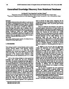
The main approaches in KDSD are characterised by the development of new algorithms that treat the objects’ position and extension through the manipulation of its co-ordinates (Ester et al., 1998, Lu et al., 1993, Koperski and Han, 1995, Koperski et al., 1998). These algorithms are subsequently implemented, extending traditional knowledge discovery systems. In all, a quantitative spatial reasoning approach is used, although the results are presented using qualitative identifiers (like far, close, North, …). This paper describes the conception and implementation of PADRÃO, a system for KDSD. PADRÃO presents a new approach to the process of KDSD based on qualitative spatial reasoning and was implemented recurring to a traditional knowledge discovery system. The spatial semantic knowledge and the principles of qualitative spatial reasoning needed for the spatial reasoning process are available in the PADRÃO’s geographic database and PADRÃO’s spatial knowledge base, allowing the integration of the data geo-spatial component in the process of knowledge discovery. The integration of a geographic database, with the administrative subdivisions of Portugal at the municipality and district level, and a demographic database, storing the parish registers of the one district of Portugal, allowed to PADRÃO the discovery of implicit relationships existing between the analysed geographic and demographic data. This paper is organised in several sections. In them, qualitative spatial reasoning is defined and described how its concepts are used in the knowledge discovery process. The architecture of PADRÃO’ is presented, describing its main components, the several steps associated with it, and its implementation. The application of PADRÃO to the demographic domain is also illustrated, referring the type of discoveries that can be achieved with it. QUALITATIVE SPATIAL REASONING The positional aspects of geographic data are provided by a spatial reference, which relate the data to a given position on the Earth’s surface. Spatial references fall into two categories: based on co-ordinates or on geographic identifiers. In systems of spatial referencing using geographic identifiers (indirect referencing systems), a position is referenced to a real world location defined by a real world object. This object is termed a location, and its identifier is termed a geographic identifier (CEN/TC-287, 1998). These geographic identifiers are very common in organisational databases, allowing the integration of the spatial component associated with it in the process of knowledge discovery. The adoption of an indirect geographic reference system imposes the use of qualitative spatial reasoning strategies, able to deal with the spatial semantic not explicitly associated with the adopted geographic identifiers. Spatial reasoning is the process by which information about objects in space and their relationships are gathered through measurement, observation or inference, and used to arrive to valid conclusions regarding the objects’ relationships (Sharma, 1996). Qualitative spatial reasoning (Abdelmoty and El-Geresy, 1995) is based on the manipulation of
qualitative spatial relations, for which composition tables facilitate reasoning, allowing the inference of new spatial knowledge. Spatial relations have been classified in several types (Frank, 1996, Papadias and Sellis, 1994), including direction relations (Frank, 1996, Freksa, 1992) (that describe order in space), distance relations (Hernández et al., 1995) (that describe proximity in space) and topological relations (Egenhofer, 1994) (that describe neighbourhood and incidence). These spatial relations are briefly described in the next subsections. Direction relations Direction relations describe where objects are placed relative to each other. Three elements are needed to establish an orientation: two objects and a fixed point of reference (usually the North Pole) (Frank, 1996, Freksa, 1992). Cardinal directions can be expressed using numerical values specifying degrees (0º, 45º…) or using qualitative values or symbols, such as North or South, those have an associated acceptance region. The regions of acceptance for qualitative directions can be obtained by projections (also known as half-planes) or cone-shaped regions (Figure 1). Figure 1: Directions definition by projection and cone-shaped systems NW
N
NE W
SW
SE
E S
A characteristic of the cone-shaped system is that the region of acceptance increases with distance, which makes it suitable for the definition of directional relations between extended objects (Sharma, 1996). Another benefit is that this system allows the definition of finer resolutions, permitting the use of eight (Figure 2) or sixteen different qualitative directions. This model uses triangular acceptance areas that are drawn from the centroid of the reference object towards the primary object (In the spatial relation A North B, B represents the reference object, while A constitutes the primary object). Since the geographic domain analysed in this work characterises administrative subdivisions, the cone-shaped system will be used in the identification of the direction relations existing between the several geographic subdivisions.
Figure 2: Cone-shaped system with eight regions of acceptance N NW
NE
W
E SW
SE S
Distance relations Distances are quantitative values determined through measurements or calculated from known co-ordinates of two objects in some reference system. The most familiar definition of distance is the length of the shortest possible path between two objects, also known as Euclidean distance. Usually a metric quantity is mapped onto some qualitative indicator such as very close or far for human common-sense reasoning (Hong, 1994, Hernández et al., 1995, Zimmermann, 1995). Qualitative distances must correspond to a range of quantitative distances specified by an interval, and should be ordered so that comparisons are possible. Another requirement is that the length of each successive qualitative distance should be greater or equal to the length of the previous one (Figure 3). Figure 3: Qualitative distances
vc
c
f
vf
Topological relations Topological relations are those relations that are invariant under continuous transformations of space such as rotation or scaling. There are eight fundamental relations that can exist between two planar regions: disjoint, contains, inside, equal, meet, covers, covered by and overlap (Figure 4). These relations can be defined considering intersections between the two regions, their boundaries and their complements (Egenhofer, 1994).
Figure 4: Topological relations
p
q
q
q p
disjoint (p,q)
p q meet (p,q)
coveredby (p,q) covers (q,p)
q p equal (p,q)
p
inside (p,q) contains (q,p)
q
p
overlap (p,q)
In some exceptional cases, the geographic space can’t be characterised, in topological terms, recurring to the eight primitives presented above. One of these cases is related with application domains in which the addressed geographic regions are administrative subdivisions. Administrative subdivisions can only be related through the topological primitives disjoint, meet and contains (and its inverse inside), since they can’t have any kind of overlapping. The topological primitives used in this work are disjoint and meet, once the implemented qualitative inference process only considers regions of the same geographic level. Integration of direction, distance and topological spatial relations Reasoning about qualitative directions necessarily involves integrated spatial reasoning about qualitative distances and directions. Particularly in objects with extension, the size and shape of objects, and the distance between them, influence the directions. One of the ways to determine the direction and distance1 between regions is calculating them for its respective centroids. The extension of the geographic entities is somehow implicit in the topological primitive used to characterise its relations. Qualitative spatial reasoning requires the adoption of a set of qualitative identifiers. In the implemented approach, integrated spatial reasoning with direction, distance and topological spatial relations, the adopted set of qualitative identifiers were: Direction = {N, NE, E, SE, S, SW, W, NW} Distance = {very close, close, far, very far} Topological = {disjoint, meet} For each of these qualitative identifiers (direction and distance, since topological relations are quantitatively by nature), is required the definition of the validity interval that limits quantitatively the region of acceptance of each one. In the case of 1
Defining distances between regions is a complex task, since the size of each object plays an important role in determining the possible distances. Sharma (Sharma 1996) enumerates as possible ways to the definition of distances between regions: i) taking the distance between the centroids of the two regions; ii) determining the shortest distance between the two regions; or iii) determining the furthest distance between the two regions.
direction relations, for the cone-shaped system with eight acceptance regions, the quantitative intervals adopted are: [337.5, 22.5), [22.5, 67.5), [67.5, 112.5), [112.5, 157.5), [157.5, 202.5), [202.5, 247.5), [247.5, 292.5), [292.5, 337.5) from N to NW respectively. In the case of distances, there should exist a constant ratio (ratio=length(disti)/length(disti-1)) relationship between the lengths of two neighbouring intervals (Hong, 1994). For example, for a ratio 42 the obtained intervals are: Ratio
dist0
dist1
dist2
dist3
4
(0, 1]
(1, 5]
(5, 21]
(21, 85]
Analysing the furthest distance that can exist between two regions of the addressed geographic domain, the ratio 4 intervals need to be magnified3 by a factor of 10, resulting in the validity intervals: (0, 10], (10, 50], (50, 210] and (210, 850] corresponding from very close to very far respectively. Qualitative spatial reasoning with the adopted identifiers requires the construction of a composition table that aggregates a set of rules, used in the inference of new spatial relations. Qualitative rules can be constructed using quantitative methods (Hong, 1994) or manipulating qualitatively the set of identifiers adopted (Sharma, 1996) (through the definition of axioms and properties for the spatial domain). The adoption of a mixed approach (Santos, 2000) allowed the integration of direction, distance and topological relations, under the principles of qualitative spatial reasoning. The composition table is represented recurring to graphical symbols, like the presented in Figure 5. In order to exemplify the set of rules stored in the final composition table, Table 1 exhibits a subset of the rules contained in it. Figure 5: Graphic symbols used in the integration of direction, distance and topological relations
N, very close, disjoint
NE, close, meet
East, close, disjoint or East, close, meet
The set of rules stored in the composition table (Table 1) can be used in the inference of new spatial relations needed in the knowledge discovery process. For example, knowing the facts A Northeast, very close, meet B and B East, close, disjoint C, it can be inferred that A East, close, disjoint C, as can be verified in Figure 6. 2
Others validity intervals, for different ratios, can by found in (Hong, 1994) or (Santos and Amaral, 2000). 3 Since the same scale magnifies all intervals and quantitative distances, qualitative inferences will remain the same (Hong, 1994).
Table 1: Excerpt of the final composition table
Figure 6: Example of the inference process A
C
B
THE PADRÃO SYSTEM PADRÃO is a system for KDSD based in qualitative spatial reasoning. This section presents its architecture and gives some technical details about its implementation. The PADRÃO’s architecture The architecture of PADRÃO (Figure 7) aggregates three main components: Knowledge and Data Repository, Data Analysis and Results Visualisation. The Knowledge and Data Repository component stores the data and knowledge needed in the knowledge discovery process. This process is implemented in the Data Analysis component, which allows the discovery of patterns or others relationships implicit in the analysed geographic and non-geographic data. The discovered
patterns can be visualised in a map using the Results Visualisation component. These components are afterwards described. Figure 7: PADRÃO’s Architecture
Results Visualisation
Geographic Database
GIS
Geographic Identifiers Schema Spatial Schema
Spatial Knowledge Base Composition Table Direction
Topology
Distance
Table 1
Table 3
Data Selection
Pattern
Table 2 ...
Cartography
Patterns Database
Geometry
Non-Geographic Database
Points
...
Knowledge and Data Repository
Data Treatment
Pre-processing
Rules
Geo-Spatial Information Processing
Lines Poligons
Data Mining
Results Interpretation
Data Analysis
The Knowledge and Data Repository component group three central databases: 1. A Geographic Database (GDB) constructed under the principles established by the European Committee for Normalisation in the CEN TC 287 standard for Geographic Information. Following its recommendations was possible to implement a GDB in which the positional aspects of geographic data are provided by a geographic identifiers system (CEN/TC-287, 1998). This system characterises the administrative subdivisions of Portugal at the municipality and district level. Also includes a geographic gazetteer with the several geographic identifiers used and the concept hierarchies existing between them. The geographic identifiers system was integrated with a spatial schema (CEN/TC287, 1996) allowing the definition of the direction, distance and topological spatial relations that exist between the adjacent regions of the municipality level. 2. A Spatial Knowledge Base (SKB) that stores all the qualitative rules needed in the inference of new spatial relations. The knowledge available in this database aggregates the composition table constructed, the set of used identifiers and the validity interval of them. This knowledge base is used in conjunction with the GDB in the inference of implicit spatial relations. 3. A non-Geographic Database (nGDB) that is integrated with the GDB and analysed in the Data Analysis component. This procedure enables the discovery of implicit relationships that exist between the geographic and non-geographic data.
The Data Analysis component is implemented through the knowledge discovery module, and is characterised by six main steps: 1. Data Selection. This step allows the selection of the relevant non-geographic and geo-spatial4 data needed for the execution of a defined data mining task. In this phase must be evaluated what is the minimal sub-set of data to be selected, the size of the sample needed and the period of time to be considered. 2. Data Treatment. This phase is concerned with the cleaning of the selected data, allowing the corrupt data treatment and the definition of strategies for dealing with missing data fields. 3. Data Pre-Processing. This step allows the reduction of the sample set to be analysed. Two tasks can here be effected: i) reduction of the number of rows or, ii) reduction of the number of columns. In the reduction of the number of rows, data can be generalised attending to the domain’s hierarchies or attributes with continuous values can be transformed into discreet values attending to the defined classes. The reduction of the number of columns attends to verify if any of the selected attributes can afterwards be omitted. 4. Geo-Spatial Information Processing. This step verifies if the geo-spatial information needed is available in the GDB. In many situations it implicitly exists, due to the properties of the spatial schema implemented. In this case, and to ensure that all geo-spatial knowledge is available for the data mining algorithms, these implicit relations are transformed into explicit relations through the inference rules stored in the SKB. 5. Data Mining. Several algorithms can be used for the execution of a given data mining task. In this step, the several available algorithms are evaluated in order to identify the most appropriate for the defined task. The selected one is applied to the relevant non-geographic and geo-spatial data, in order to find implicit relationships or other interesting patterns that exist between them. 6. Results Interpretation. The interpretation of the discovered patterns aims to evaluate their utility and importance to the application domain. In this step it may be realised that relevant attributes were ignored in the analysis, suggesting that the process should be repeated. The relevant discoveries can be stored in the database of patterns, allowing its subsequent use in further analyses (meta-rules construction) or its visualisation in a map. The Results Visualisation component is responsible for the management of the discovered patterns and its visualisation in a map. For that, PADRÃO uses a Geographic Information System (GIS), integrating the discovered patterns with the cartography of the analysed region. This component aggregates two main databases: 1. The Patterns Database (PDB) that stores all relevant discoveries. In this database, each discovery is catalogued and associated with the set of rules that represents the discoveries made in a given data mining task.
4
The term geo-spatial is used to emphasise that geographic data has associated spatial data. Traditionally, geographic data is associated with a location, positioning an object or fact in space, while spatial data defines the characteristics of that localisation, namely its geometry and topology.
2. A Cartographic Database (CDB) with the cartography of the region. It aggregates a set of points, lines and polygons with the geometry of the geographical objects. The PADRÃO’s implementation PADRÃO has been implemented using Microsoft Access, the relational database system; Clementine (SPSS, 1999), the knowledge discovery tool, and Geomedia Professional (Intergraph, 1999), the GIS used for the graphical representation of results. The overall set of databases that integrates the Knowledge and Data Repository and the Results Visualisation components were implemented in Access. The data stored in them are available to the Data Analysis component, or from it, through ODBC (Open Database Connectivity) connections. Clementine is a data mining toolkit based on visual programming5, which include machine learning technologies like rule induction, neural networks, association rule discovery and clustering. The knowledge discovery process is defined in Clementine through the construction of a stream, in which each operation on data is represented by a node. Figure 8 presents a view of the workspace of Clementine, in which it is possible to see several sets of icons, grouped into palettes according to their functions: links to sources of information, operations on data (rows or columns), visual facilities and modelling techniques (data mining algorithms). The figure already points out the space used to the streams construction (stream pane, the main work area) and the generated models palette. The PADRÃO’s Data Analysis component recurs to the construction of several streams that implement the knowledge discovery module. The several models obtained in the data mining phase represent knowledge about the analysed data, and can be saved or reused in others streams. In PADRÃO, these models can be exported through an ODBC connection to the PDB. Its integration with the CDB allows its visualisation in a map.
5
Visual programming involves placing and manipulating icons representing processing nodes.
Figure 8: Clementine’s workspace
Stream Pane
Generated models palette
Palettes
THE KNOWLEDGE DISCOVERY PROCESS IN PADRÃO The nGDB, of the Knowledge and Data Repository component, used in this application of PADRÃO is a Demographic Database (DDB) that stores the parish registers dated between 1690 and 1990 in the Aveiro district. This database collects attributes like birth date, birthplace, death date, death place, occupation, number of descendants, number of marriages, etc. The several attributes related to places allow the integration of the DDB with the GDB, providing the geo-spatial data needed in the knowledge discovery module. Table 2 presents some records of the individual table, in which is possible to see the existence of some missing data fields and attributes with continuous values, requiring its transformation into discreet values. At the geographical level, the demographic data will be generalised at the municipality level. Following some suggestions (Rodrigues et al., 1999) of possible concept hierarchies for demographic data, Table 3 systematises the several hierarchies used, and the classes defined for the transformation of continuous attributes into discreet values.
Table 2: Some records of the individual table
Table 3: Hierarchies and classes for data reduction Attributes
Hierarchies / Classes for Discreet values
Place
Place Æ Parish Æ Municipality Æ District
Date
Year
Month
{1600..1699} Æ 17, {1700..1799} Æ 18, {1800..1899} Æ 19, {1900..1999} Æ 20 {January, February, March, April, May, June, July, August, September, October, November, December} Æ {1, 2, 3, 4, 5, 6, 7, 8, 9, 10, 11, 12}
Age
{0..12} Æ 0-12, {13..25} Æ 13-25, {26..45} Æ 26-45, {46..110} Æ 46-
Children
{0} Æ 0, {1..3} Æ 1-3, {4..6} Æ 4-6, {7..16} Æ 7-
The definition of an objective for the discovery requires its transformation in a data mining objective. In the example presented here, the objective was to find a model that characterise the age at death and the number of children attributes for the analysed geographic region. Transforming this objective in a data mining objective begins with the selection, treatment and pre-processing of the relevant data. After the data selection, all missing data fields were marked as unknown (‘?’) and the continuos attributes were transformed into discreet values attending the classes previously described. Figure 9 presents the stream charged with the execution of these three steps. By its analysis it is possible to verify that the first node (DB_AVR:Individual) makes the data available through an ODBC connection. After that, the filter node permits the selection of the relevant attributes and the filler node substitutes all missing data fields by a ‘?’. The Child_class node assigns the correspondent class to the number of Children attribute; the Age node calculates the age at death of the individuals, based on the attributes Birth_date and Died_date. The result is used by the Age_class node, which assigns to each value the respective class. The figure also presents the
CLEM6 code used in two of the nodes, the Age and Age_class nodes, and a table
with a set of the resulting records. Figure 9: Selection, treatment and pre-processing of data
if Died_date/='?' and Birth_date/='?' then intof(date_years_difference(Birth_date,Died_date)) else '?' endif
if Age/='?' then (if Age>=0 and Age=13 and Age=26 and Age