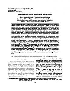
Dead reckoning is a popular method, but is not reliable for long distances or uneven surfaces because of variations in wheel diameter and slippage. The.
Study on Cooperative Positioning System
(Basic Principle and Measurement Experiment) Ryo Kurazume and Shigeo Hirose
Shigemi Nagata and Naoki Sashida
Tokyo Institute of Technology 2-12-1, Oo-okayama Meguro-ku, Tokyo 152, Japan
FUJITSU LABORATORIES LTD. 1015, Kamikodanaka Nakahara-ku, Kawasaki 211, Japan
Abstract Several position identification methods have been used for mobile robots. Dead reckoning is a popular method, but is not reliable for long distances or uneven surfaces because of variations in wheel diameter and slippage. The landmark method, which estimates current position relative to landmarks, cannot be used in an uncharted environment. We have proposed a new method called ”Cooperative Positioning System (CPS).” For CPS, we divide the robots into two groups, A and B. One group, A, remains stationary and acts as a landmark while group B moves. Group B then stops and acts as a landmark for group A. This ”dance” is repeated until the target position is reached. By using the concept of ”portable landmarks”, CPS has a far lower accumulation of positioning error than dead reckoning, and can work in three-dimensions which is not possible with dead reckoning. CPS, therefore, can work in uncharted environments. In this paper, we outline a second prototype CPS machine model (CPSII) and report the results of position identification experiments. Experimental results using this model give a positioning accuracy of 0.4% for position and 1.0 degree for attitude.
1
Introduction
Control of mobile robots traveling in an uncharted environment necessarily requires a method of identifying the positions of the robots. A number of position identification techniques for mobile robots have been proposed. The methods can be roughly classified into two types: dead reckoning and landmark. The dead reckoning method [14] identifies robot positions by calculating the amount of travel from the starting point. It does this by integrating rotations of the right and left wheels, such as on wheel-driven vehicles. This method is simple and is easily implemented. It can also identify robot positions in an uncharted environment because it only employs internal sensors. The dead reckoning method, however, has a serious problem. Wheel slippage causes measurement errors, which accumulate as the vehicles travel. Dead reckoning
does not work in three-dimensions involving differences of elevation. The landmark method [5-7] identifies the position of a mobile robot by measuring the current position relative to landmarks at identified positions. There are many types of landmark methods depending on the type of landmark and how it is placed. The use of the shape of the horizon line [8-9] and stationary satellites (GPS) are classified under the landmark method. This method features high measurement accuracy with no accumulation of measurement error. It also provides three-dimensional information including elevation. However, it has a great drawback in that the environment around the mobile robot must be known and the specified landmarks must be placed in the environment in advance. As a solution to the problems presented by both methods, we have proposed a new method called ”Cooperative Positioning System (CPS)[10].” This method covers the weaknesses of the previous two methods and enables position identification even in uncharted environments and uneven surfaces. CPS uses multiple robots each equipped with sensors to measure their positions relative to one another. The entire group of robots moves while at least one robot remains stationary, acting as a landmark for the others. This operation is repeated while relative positions are measured until the target robot position is reached. In this paper, we first discuss the basic principles of the proposed CPS. We then outline a new second prototype CPS machine model (CPS-II) and report the results of position identification experiments using the model. CPS-II consists of a master robot equipped with a high-precision laser range finder and two slave robots equipped with corner cubes.
2
Cooperative Positioning System (CPS)
2.1 Standard CPS Configuration The proposed cooperative positioning system (CPS) with multiple robots may be referred to as a mobile landmark method. In this section, we define the basic principles of CPS clearly and show examples of standard CPS con-
figuration. Robots were divided into two groups, groups A and B. 1. While robot group A with its initial position identified remains stationary, robot group B travels a certain distance. The position of traveling group B is roughly determined by measuring its position relative to group A and using internal sensors as well.
P2
zZ
y
r φ
2. After group B travels an arbitrary distance, its position is accurately measured in reference to the position of group A.
P1
θ
3. Group B then remains stationary while group A travels an arbitrary distance. 4. Steps 1 to 3 are repeated until the position of the target robot group is reached. Figure 1 and 2 show how positioning is actually performed with CPS. Figure 1 shows an example using two robots. When position P 1 x1 ; y1; z1 of stationary robot 1 is known, CPS is implemented as follows: First, the threedimensional position P 2 x2; y2 ; z2 of robot 2 that moved and stopped is determined, as indicated by the solid line. This is done by measuring distance r between the robots, azimuth angle � of a turn against the vertical axis in the direction of gravity, and elevation angle � from the level surface and assigning these measurements in the following equations:
(
x2 y2 z2
= = =
(
)
(
=
x3
y3
)
+ r cos � cos � y1 + r cos � sin � z1 + r sin � x1
(x2
= z3
)
x1t1
=
(1) (2) (3)
(
+ (y2
x2 t2 t1
t2
)
+
)
)
y1 t1 t2
x1 t1 t2 y1 t1 t1 t2
y2 t2
+ c1(t1t2 t2) l tan �1 = z2 + c (t t1 t ) l tan �2
(4)
(5)
z1
2 1
Figure 1: Type 1 positioning principle
)
Next, robot 1 moves as indicated by the dotted line. The position where robot 1 stops is determined in reference to the position of robot 2. These operations are repeated. Figure 2 shows an example using three robots. When positions P 1 x1; y1 ; z1 of robot 1 and P 2 x2; y2 ; z2 of robot 2 are known, CPS is implemented as follows: First, position P 3 x3 ; y3; z3 of robot 3 that moved and stopped is determined, as indicated by the solid line. This is done by measuring azimuth angles �1 and �2 and elevation angles �1 and �2 of robot 3 as seen from robots 1 and 2 and assigning these measurements in the following equations:
(
x
2
(6)
where tn
= tan �n; l
=
p(x
cn
2
= cos �n (n = 1; 2) ) + (y2
x1 2
)
y1 2
(7)
(8)
Next, robot 1, for instance, moves as indicated by the dotted-line arrow. The position where robot 1 stops is determined in reference to the positions of robot 2 and 3. These operations are repeated. CPS is not limited to these examples; many other configurations are possible. For instance, the position of one robot relative to two stationary robots in Figure 2 may be determined differently. That is, instead of being identified by a combination of azimuth angle � and elevation angle �, the determination may be based on a combination of distance r between robots and elevation angle �. Another CPS, unlike the one that classifies robots into two groups, may cyclically select stationary robots from a group of robots to allow the entire group to move continuously. Another CPS may determine more accurate positions based on redundant measurements from a number of stationary robots. In [10], we have already discussed its positioning accuracy using the error variances, and the suitable moving strategies with several triangle chains. 2.2 CPS Characteristics CPS position identification has the following characteristics: 1. CPS determines position by repeated measurement and therefore accumulates positioning errors as with the dead reckoning method. However, CPS has far fewer positioning errors because it can accurately determine position and attitude by measuring stationary
y
P3
zZ
φ1 P1
φ
θ1 θ
2
2
P2
x Figure 2: Type 2 positioning principle
markets. This cleaning robot could clean a wide area based on a map. Dead reckoning based on wheel rotation has some problems for this application. One of these problems is errors in movement measurement caused by slippery floors. Another problem is the substantial azimuth measurement errors likely to occur when the cleaning robot runs against a wall or pillar. In addition, a cleaning robot would probably need to go up and down stairs and clean floors that have uneven surfaces. As stated in item 3 above, dead reckoning, which cannot work for three-dimensional measurement, is inappropriate for this application. The landmark method is not effective, either, because landmarks will not necessarily be placed in advance in many environments. GPS, which is remarkably effective outdoors, cannot be used for cleaning indoors. CPS is an effective method for cleaning indoors that have uneven surfaces and many obstacles. Furthermore, in this application, it is effective to use multiple cleaning robots and all that is required is to equip each robot with a measuring device as shown in Figure 3.
points in the same way as the surveying. CPS provides a good basis for extraordinarily higher positioning accuracy than does the dead reckoning method based on wheel rotation. 2. Unlike the landmark method, CPS does not require prior placing of landmarks. It allows movement in an uncharted environment or even underground where Global Positioning System (GPS) cannot be used. 3. By measuring elevation angles, CPS can determine three-dimensional positions, which is not possible with dead reckoning. In contrast, CPS has the following problems: 1. At least two robots are required. 2. At any one time, at least one robot must be stationary, which slows down overall speed. 3. An accurate measuring device (including a device that measures a robot’s attitude relative to gravity) must be built into each robot. Items 1 and 2 are not problems if an application essentially uses multiple robots and does not require high-speed movement. Item 3 depends on technological innovation in the field of measuring instruments, which has been rapidly progressing. The authors believe this problem will soon be solved. The performance of the prototype measuring instrument we assembled will be discussed later. 2.3 Fields of CPS Applications We believe that CPS that has the foregoing characteristics can be used effectively if proper applications are selected. Two possible applications are discussed below. One application is the automatic control system of a robot that cleans the inside of train stations or underground
Figure 3: CPS application for cleaning robots The point to be specifically noted for CPS is that any disturbance of the cleaning robots while working, such as a collision with a obstacle, has no effect on positioning accuracy. A system configuration consisting of cleaning robots and a dedicated measurement robot is also a possibility. Each cleaning robot is equipped with only a marker light source. The dedicated measurement robot is equipped with sensors that measure the distance to and the angle of the marker light source in each cleaning robot. This configuration provides an inexpensive implementation of CPS. Another possible application is the use of robots to explore unknown environments, such as planets. For this type of investigation, use of many small robots is most effective to take advantage of the high reliability of a redundant system. Some researchers have previously advocated the effectiveness of this multiple robots approach. The authors also have proposed a new concept of multiple planetary rovers “Gunryu” and developed a prototype [11] as shown in Figure 4. The “Gunryu” consists of multiple mobile robot with manipulators. These robots usually operate individually. As they move over an uneven surface, they are
connected to one another using the manipulators. Suppose the multiple robots such as the “Gunryu” move around over an uncharted planet to perform a geological survey or make a detail topographical map. For position identification, both the dead reckoning and landmark methods are inappropriate from the standpoint of required precision and environmental conditions. In contrast, CPS has almost no problems with this application and is essentially effective. Furthermore, each robot of the “Gunryu” must come close to one another for connection or break away from one another for separation. Therefore, it is assumed that each robot is equipped with a relative position measuring sensor. CPS can thus be used for the “Gunryu” as is without adding new measuring devices.
2. To calculate the position of robot 1, robot 0 measures the distance l1 , azimuth angle �1 , and elevation angle �1 relative to robot 1. 3. Similarly, to calculate the position of robot 2, robot 0 measures the distance l2 , azimuth angle �2 , and elevation angle � 2 relative to robot 2. 4. Robot 0 moves and then stands still. 5. To calculate the position and attitude of robot 0, robot 0 measures the distances l1 and l2 , azimuth angles �1 and �2 , and elevation angles �1 and �2 relative to robots 1 and 2. 6. Return to 1.
Figure 4: Cooperative multiple robots “Gunryu” in planet exploration
3
Move and Measurement Experiment
This section outlines a new prototype CPS machine model (CPS-II), and reports the results of position identification experiments using the model. CPS-II consists of a master robot equipped with a high-precision laser range finder and slave robots each equipped with corner cubes. This prototype system is capable to :
� � �
Search for other robots. Measure the distance to and azimuth angle of other robots. Automatically move each robot based on the measurement results.
3.1 Principles of Measurement in CPS-II CPS-II consists of one master robot, 0, equipped with a laser range finder and two slave robots, 1 and 2, each equipped with corner cubes. The master and slave robots move while alternately performing position identification according to the following procedure: First, the initial position and attitude of robot 0 are measured, then 1. Robots 1 and 2 move and then stand still.
The above operation cycle is repeated until the entire robot group reaches the target position. 3.2 Outline of CPS-II Figure 6 shows our experimental system. The master robot is equipped with a laser range finder of TOPCON Ltd. (Table 1) that is capable to search and trace a corner cube in arbitrary position automatically and a 2-axis inclinometer. By detecting laser reflected from the slave robots, the master robot automatically and accurately measures the distances from the slave robots and the azimuth angles. On top of each slave robot are six corner cubes arranged at intervals of 60 degrees around the vertical axis. This mechanism can accurately reflect a laser beam that project form any direction. Each robot has a built-in microcomputer ( 8086-8MHz, Japan System Design Co., Ltd. ), driving circuit, battery ( Yuni-Z, YUASA BATTERY Co., Ltd. ) , and communication system ( HRF-600 (RS-232C), HERUTU Co,. Ltd. ), and is controlled centrally from the host computer ( S-4/Liea, Fujitsu Ltd. ).
Table 1: Range finder specifications AP-L1 (TOPCON Ltd.) Range 4 � 400 [m] Distance resolution 0.2 [mm] Angle resolution 5 [”] Distance precision �3+2ppm [mm] Angle precision �5 [”]
3.3 Move and Measurement Experiment An experiment for measuring positioning accuracy was performed using our prototype mobile robot system (CPSII) in an indoor environment. In this experiment, three robots traveled on an even surface along the wall in a room measuring 6 m x 12 m. The robots traveled around the room clockwise while repeatedly determining their position using CPS. When they returned to almost same area
1 1
0
0
l1
θ1 φ1 2
2
(1) Robot 1 and 2 move.
Parent robot
(2) Robot 0 measures robot 1.
Child robot 1 1
0
0
θ2
φ2
l1
φ1 θ1 θ2
Figure 6: Appearance of the robot system
φ2
l2
(3) Robot 0 measures robot 2.
Child robot 2
1
2
l2
2
(4) Robot 0 moves and measures robots 1 and 2.
Figure 5: Experimental CPS system
This experiment was performed on a even surface with no roughness. The positioning accuracy of CPS, however, is not affected by an environment where CPS is used. It is expected that the positioning accuracy obtained by this experiment could also be obtained easily in an uneven outdoor terrain, and obtained accuracy of CPS can be far better than that of dead reckoning.
1m
of the initial positions, the position of the master robot was compared with it’s initial position determined by fixedpoint measurement. Figure 7 shows how the robots moved in this experiment. In this figure, the master robots are each represented by a square and the slave robot is represented by a circle. The three robots started from their original positions (indicated by an up-side-down triangle at the lower left) along the y axis. They repeated the operation cycle shown in Figure 5 ten times to return to their initial positions. The route traveled by the master robot is indicated with a solid line in the figure. Table 2 lists the average positioning errors of position and attitude of the master robot. The total travel distance of the master robot was 21.6 m. The average positioning error was 82.3 mm (0.38% of the total travel distance); the average attitude error was 1.0 degree. For comparison, a robot with an encoder of 47,520 pulses per rotation attached to its driving wheel was simply moved in a straight-line with the distance of 5 m and measured positioning accuracy of dead reckoning. The positioning accuracy was 1.4% of the total travel distance. Next, the robot traveled in the same environment of Figure 7 with dead reckoning only. The route traveled by the robot is indicated with a dotted line in Figure 7. When a change of direction was involved, azimuth errors greatly affected the positioning accuracy, pushing the error rate up to as much as 10%. This proves that CPS can determine position with a much higher precision than dead reckoning can.
CPS
Dead Reckoning
Final position
Initial position
y x
Figure 7: Experimental results
4
Conclusion
We have proposed the cooperative positioning system (CPS) that can accurately determine the positions of multiple robots through cooperative control of individual robots
Table 2: Position and attitude accuracy of CPS-II after robot 0 moves a distance of 21.6 m
�x �y �z
79.5
17.8
11.5
Average 82.3
��
1.0
[9] K. T. Sutherland and W. B. Thompson, Localizing in Unstructured Environments: Dealing with the Errors, IEEE Trans. on Robotics and Automation, Vol. 10, No. 6, pp.740-754, 1994. [10] R. Kurazume, S. Nagata, and S. Hirose, Cooperative Positioning with Multiple Robots, Proc. IEEE Int. Conf. on Robotics and Automation, Vol. 2, pp. 1250-1257, 1994. [11] S. Hirose, N. Ootsukasa, T. Shirai, H. Kuwahara, and K. Yoneda, Fundamental Considerations for the Design of a Planetary Rover, Proc. IEEE Int. Conf. on Robotics and Automation, pp. 1939-1944, 1995.
in the group. We then discussed that CPS enables highly accurate positioning of mobile robots in an uncharted or uneven environment, which was difficult previously, and that CPS can be used in several fields. Next, we reported the results of an experiment using a prototype system equipped with a laser range finder. This experiment show that CPS could perform far more accurate measurements than the dead reckoning method even in uneven environments.
References [1] R. Chatila and J. laumond, Position Referencing and Consistent World Modeling for Mobile Robots, Proc. of IEEE Int. Conf on Robotics and Automation, pp.138-145, 1985 [2] J. L. Crowley, Dynamic World Modeling for an Intelligent Mobile Robot Using a Rotating UltraSonic Ranging Device, Proc. of IEEE Int. Conf. on Robotics and Automation, pp.128-135, 1985 [3] Y. Watanabe and S. Yuta, Estimation of Position and its Uncertainty in the Dead Reckoning System of the Wheeled Mobile Robot, Proc. of 20th ISIR, pp.205212, 1990. [4] T. Tsubouchi and S. Yuta, Map Assisted Vision System of Mobile Robots for Reckoning in a Building Environment, Proc. of IEEE Int. Conf. on Robotics and Automation, pp.1978-1984, 1987 [5] L. Matthies and S. A. Shafer, Error Modeling in Stereo Navigation, IEEE J. of Robotics and Automation, Vol. RA-3, No. 3, pp.239-248, 1987. [6] H. Nasr and B. Bhanu, Landmark Recognition for Autonomous Mobile Robots, Proc. of IEEE Int. Conf. on Robotics and Automation, pp.1218-1223, 1988 [7] E. Krotkov, Mobile Robot Localization Using A Single Image, Proc. of IEEE Int. Conf. on Robotics and Automation, pp.978-983, 1989 [8] R. Talluri and J. K. Aggarwal, Position Estimation for an Autonomous Mobile Robot in an Outdoor Environment, IEEE Trans. on Robotics and Automation, Vol. 8, No. 5, pp.573-584, 1992.