Invited Paper
Landslide Monitoring with Sensor Networks: a Case for Autonomic Communication Services Alberto Rosi1, Marco Mamei1, Franco Zambonelli1, Antonio Manzalini2 1) Dipartimento di Scienze e Metodi dell’Ingegneria Università di Modena e Reggio Emilia 42100 Reggio Emilia – ITALY {alberto.rosi, marco.mamei, franco.zambonelli}@unimore.it 2) Telecom Italia 10148 Torino – ITALY
[email protected]
Abstract. Wireless sensor networks can be a very useful technology for monitoring remote and hostile environments. In this paper, we firstly report on our experience with landslide monitoring, and analyze the issues and the challenges we had to face in programming and deploying a suitable and useful wireless sensor network infrastructure. Following, we discuss how, within the CASCADAS project, we are contributing to the development of a novel component-based framework to facilitate the design and development of autonomic and situation-aware communication services for the use in modern network scenarios. Such a framework can become a useful tool to facilitate the development of easy-to-deploy, robust, and flexible sensor-network-based monitoring systems and, in particular, of landslide monitoring systems. Keywords. Wireless Sensor Networks, Landslide Monitoring, Autonomic Communication Services.
I. INTRODUCTION Wireless sensor networks are attracting an increasing interest due to their potentials for applicability in a variety of scenarios [1, 3, 4, 5]. In particular, sensor networks appear an essential tool for monitoring physical and natural phenomena in hostile and remote environments such as wildlife habitats [9], glaciers [6], active volcanoes [12] and active landslides [11]. The number of real-world deployments of sensor network systems is rapidly increasing. From our side, we have experienced with the design, development and deployment of a sensor network infrastructure for landslide monitoring in the Emilia Romagna Apennines. Such infrastructure, which is now at work on site, enables the fine-grained analysis of environmental parameters and of slope movements and aims both at a better understanding of the phenomena and at generating alarms in the case potentially dangerous movements.
What characterizes most of the existing deployments, there included ours, is that they have to rely on a variety of technologies and ad-hoc techniques to deal with scenariospecific problems. From the software viewpoint, this introduces every time notable specific complexities to develop a system and to make it flexible, robust, and capable of adapting to contingencies. Accordingly, the availability of a general-purpose framework to support the development of autonomic applications and communication services over these kinds of environments would be highly desirable. Against this background, the contribution of this paper is twofold. First, we present the landslide monitoring infrastructure we have developed (Section 2) and analyze the main challenges and problems – some of which of a very general nature – we had to face in this process (Section 3). Second, we present and discuss the autonomic framework being developed within the CASCADAS project (Section 4). Such framework, which aims at supporting and facilitating the development of autonomic and adaptable distributed communication services in modern network scenarios, could effectively address the above challenges and simplify the development and deployment of sensor network infrastructures and associated services. II. LANDSLIDE MONITORING WITH WIRELESS SENSOR NETWORKS Existing assessed technologies for monitoring slope stability consist of mostly isolated systems (e.g., multi-point bore hole extensometers, tilt sensors, displacement sensors, and volumetric soil water content sensors), typically very costly, and requiring complex installation procedures. Sensor networks exhibit several advantages over such technologies, which motivated our efforts towards the deployment of a sensor network infrastructure for monitoring landslides in the Emilia Romagna Apennines.
A. Advantages of Sensor Networks There are several characteristics of wireless sensor networks that make them suitable and highly competitive for landslide monitoring. In particular: 1. Wireless communications allow monitoring an environment remotely, without being in that location. This feature is of basic importance for landslides, which are typically found in difficult-to-be-reached and uncomfortable environments such as sharp mountains and quick slopes. 2. A sensor network can collect, aggregate, and analyze diverse and distributed data, and detect patterns that would be otherwise very hard to identify. In the case of landslides, this could enable (e.g., by analyzing humidity, temperature, pressures and strains on different regions of the ground) to detect changes in the patterns of movement well before these becomes apparent and dangerous. 3. Sensor network could (at least in theory) be deployed without requiring any pre-existing infrastructure and very quickly. For landslides, this could enable putting in place in a few hours an emergency monitoring system whenever new dangerous landslide surfaces appear. 4. Sensor network can be distributed also on wide areas at limited costs. For landslide surfaces, which can extend over several square kilometers, this is a very important characteristic.
5. Energy-efficient algorithms for sensor network have been developed allowing the network to run for months without human intervention at nearly no costs. For landslides, which can stay silent for several months and then suddenly re-vitalize, this is a very important feature to ensure continuous, long-term yet low-cost, monitoring. B. The Calita Infrastructure The Emilia Romagna Apennines, in Italy, are characterized by the presence of several large-scale landslides phenomena, most of which representing a danger to villages and roads. As the monitoring all such phenomena is costly and unsatisfactory with current technologies, we have started a collaboration with the Department for Environmental Protection of the Regione Emilia Romagna and with the Department of Earth Sciences of the University of Modena and Reggio Emilia, aimed at experiencing the usage of sensor network technologies. A landslide by the village of Calita (county of Reggio Emilia) has been chosen for the first prototypical development and deployment. The Calita’s infrastructure (see Figure 1) has been deployed in May 2007 and it’s still at work. It exploits 15 Crossbow Micaz motes and covers a surface of about 500 square meters. It exploits accelerometers for capturing slope movements, and environmental boards for the monitoring of ambient parameters like temperature, pressure, humidity and light depth.
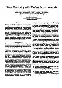
Figure 1. General architecture of the landslide monitoring application.
Figure 2. A screenshot of the monitoring Web site (http://155.185.228.148/calita).
Over the landslide surface, each Micaz node has been assigned either the role of “Data” or “Bridge” node. Data nodes are in charge of sampling data from the environment and sending it to bridge nodes. Bridge nodes, following a predetermined static routing table, forward packets to a base station placed in a safe position, 50 meters far from the observed landslide. A base-station mote, connected to a laptop, retrieves network packets. The laptop, exploiting FTP over a UMTS connection, sends data to our servers at the university. There, a Java application elaborates data and stores it in a MySQL database. More in general, application agents running on both sensor nodes and on the backend server infrastructure take care of retrieving sensor data, collect it to a central base station, and deliver it to our campus’ server cluster. Retrieved data is processed and elaborated by other application software agents that present their result via a Web 2.0 graphical user interface. The site displays the sensor network as an overlay over Google Maps, through the Google Maps’ marker the user can access aggregated sensors data (based upon day, week or month time range). Moreover, the site provides weather reports and precipitation data, coming from a weather station sited in the landslide area. An alarm window displays alarms and warnings about the landslide status. Figure 2 shows a screenshot of the Web site that is reachable at http://155.185.228.148/calita. Early analysis of data confirms that our infrastructure is able to identify most slopes’ motion patterns detected by other traditional tools already in place there. Whether it can do more is still to be evaluated. However, the analysis of these results is beyond the scope of this paper. III. CHALLENGES The deployment of the above described wireless sensor
network for landslide monitoring have posed us several challenges, either related to sensors’ inherent characteristics, or to the characteristics of the target scenario [4], or both. A. Deployment and Reconfiguration Time A key challenge in landslide monitoring is ensuring fast deployment time, i.e., being able to put at work a functional monitoring system very quickly. When a new landslide surface (not previously monitored) emerges and starts moving, it is very important to start monitoring it immediately. Strictly related, because the characteristics of a landslide surface can change over time, and sometimes even very quickly and unexpectedly, it is necessary to be able to reconfigure the structure of the monitoring infrastructure to meet the new monitoring requirements. Although most of the literature on sensor networks claims that sensor network can be deployed with little or no configuration costs, due to lack of wires and selforganization, our experience is dramatically different. First, we had to properly study the packaging of sensors and their placement on the ground, to limit noise on measurements and to protect sensors, which is per se time consuming. Second, and more technically challenging, we had to spend a lot of time (both in the lab and on the field) to properly calibrate sensors to the specific characteristics of the landslide, as well as to study and implement proper routing strategies (see also next sub-section). Finally, to enable meaningful analysis of data, we also had to book-keep the characteristics of the sensors’ placement and transfer this information on the server site. B. Robustness and Fault Tolerance Aiming at robustness and reliability is normal in any engineering project, and it becomes compulsory in
challenging dynamic environments, as in landslides. During our deployment, we have experienced several reliability problems. First, the movement of some nodes due to movements of the landslide surface could lead (and has let to) unreachability of some of the nodes. Second, some nodes sometimes have experienced unexpected early battery exhaustion problems. Finally, sometimes we have simply discovered bugs in the programming of some of the sensors. Additional problems have been caused by the instability of the UMTS connections with the central services. In general, it is claimed that sensor networks can cope gracefully with faults, i.e., the lost of some nodes or changes in the network topology, due to the possibility of enforcing redundancy in sensing capabilities and self-reconfiguration of routing paths. However, in our experiences, this has been far from easy. On the one hand, redundancy has a cost in terms of hardware, and we were not in the position of properly enforcing it. On the other hand, flexible routing and data collection strategies have a cost in terms of programming and batteries, for which we had to opt for a static routing strategy (see also next subsection). C. Energy Consumption Battery-powered sensor networks (as we had to necessarily exploit in the landslide site) have to face the issue of limiting power consumptions to increase lifetime. This introduces the need of finding the proper trade-off between performances (i.e., accuracy of sensing and amount of collected data) and lifetime. In our experience, it has been very difficult to find out such trade-off. For instance, for inertial sensors, it was simply unknown what minimal sampling rate would have enabled us to gather all relevant information. Thus, we had to make several tests on the field before finding this out. As a second problem, we have found out that the energy cost of enforcing dynamic routing was too high to ensure a reasonable lifetime. Finally, we have had problems in devising a strategy of ensuring balanced energy consumption among nodes, and avoiding bridge nodes close to the base station to go out of batteries too soon. As of now, we are able to ensure an average lifetime of one-month to the infrastructure and, at the same time, to be able to gather accurate enough information about the phenomena occurring in the landslide. Of course, this requires us taking care of monitoring battery status and of going on the field to replace them when needed. D. Heterogeneity and Interoperability From a technical point of view one of the main challenges is related to devices heterogeneity and the problems associated to their interoperability. Sensor network scenarios are typically composed by different kind of devices ranging from micro-sensors for fine-gain readings, to large backend servers to process and store retrieved data. When developing applications, it is important to take such differences into consideration and thus wrote software for a lot of different
platforms having very different resources and constraints. In our implementation of the landslide monitoring infrastructure, we had to deal very diverse programming techniques: • Sensor nodes are micaz devices with TinyOS operating system. We developed their software with the nesC programming language. • The base station runs Linux with software written in Java and C. The application we developed has to bridge packet from a Zigbee network to a UMTS one (overcoming networking heterogeneity). • Backend servers have WinXP operating system and run software written in Java. Of course, this has notably increased the complexity of our development, and has posed us notable interoperability challenges. IV. THE CASCADAS APPROACH The CASCADAS project (www.cascadas-project.org) aims at defining a general-purpose component-based paradigm (and at producing an associated development framework) for autonomic and situation-aware communication services. The key concept at the root of CASCADAS is the ACE (Autonomic Communication Element) [7], intended as a unifying software engineering abstraction for the development of component-based distributed services. The ACE model leverages existing autonomic component-models [8] and adaptive agent-based models [13] with features conceived to facilitate the design and development of complex, self-adaptive and self-organizing, services. In particular: 1. ACEs are conceived to run both on high-end computers as well as on tiny devices like sensors. Moreover ACEs can dynamically relocate themselves to different devices at run time by making use of mobile code techniques [10]. 2. The internal behavior of an ACE is formally and explicitly represented by means of a finite state automaton, which allows tracing and supervising all internal activities. A specific reasoning engine can be integrated within ACEs to take advantage of this feature and enforce not only autonomic control loops within ACEs [8] but also selfadaptive modifications of the ACE structure and behavior. 3. To enforce dynamic self-organization of distributed multicomponent services, ACEs rely on a flexible discovery and interaction model. A semantic-based discovery mechanism called GN-GA (Goal Needed / Goal Achievable) [7] enables ACEs to be engaged on-the-fly in flexible and dynamic interactions. It also enables ACEs to dynamically self-aggregate with each other to collectively enforce distributed functionalities (e.g., adaptive routing and resource management policies). 4. The ACE model supports context-awareness via the access to a flexible and expressive external knowledge substrate, which leverages existing models of contextawareness [2] and existing agent-based environmental models [13] with capabilities of self-organizing
knowledge management and knowledge generation. This notably facilitates ACEs in dynamically adapting their individual/collective behaviors on the on the basis of the current situation of the context. All the above characteristics provide features that would make facing the identified challenges for the landslide monitoring infrastructure much easier. A. Deployment and Reconfiguration Time One of the main challenges we experienced with the landslide application scenario is the need for a fast deployment and reconfiguration time of the sensor network. As stated in Subsection III.A, we had to face problems related to time hostility of the location, costing configuration and sensor calibration activities, complex routing issues, and bookkeeping activities. The ACE model can support and notably simplify some parts of this process notably: 1. An ACE is mobile and can be relocated on different devices on the fly [10]. Thus, new experiments can be set up and deployed without physically accessing the sensor nodes and without having to stay in an uncomfortable and hostile location. 2. Internal autonomic capabilities in ACEs can be used to enforce self-calibration of sensors, also in reaction to changed environmental conditions. 3. Flexible communication services, there included dynamic routing, can be easily enforced in ACEs. In particular, ACEs can dynamically discover each other via the GNGA protocol and dynamically self-aggregate to discover and establish multi-hop communication routes. 4. ACE services can be semantically annotated to enable high-level and flexible access to them. This kind of semantic annotation can be useful to support bookkeeping activities in that semantically annotating collected data would drastically improve data organization. B. Robustness and Fault Tolerance Another important challenge we faced in the landslide application scenario (as from Subsection III.B) is supporting robustness and fault tolerance. ACEs can deal with these kind of problems by autonomically reconfiguring their activities on the basis of the current system situation. Network reconfigurations, possibly leading to partitions are the most severe treats the ACEs have to deal with, in particular: 1. ACEs can detect individual broken links and fix routingtable lines accordingly. 2. The addition of new sensors on the fly can be taken into account by having ACEs run discovery protocols to detect new neighbors. 3. Network partitions or massive node faults can trigger specific autonomic services for network reconfiguration. For example, in case of network partitions, ACEs can control the low-level hardware of the network card to increase the power of the wireless signal to detect far
away neighbors. These autonomic behaviors drastically increase the robustness and the life span of a sensor network. C. Energy Consumption Reducing and balancing the energy consumption over the sensor network is a key challenges to create a viable landslide monitoring application. ACEs support this process in three important ways: 1. From the networking point of view, ACEs can run autonomic algorithms to balance the overall energy consumption of the network. Accordingly, the routing tree to collect data to the base station can be reconfigured optimizing the overall energy expenditure. For example, an almost discharged node can be left out from the routing tree and become a leaf node. 2. From the data acquisition point of view, ACEs can dynamically tune sensor sampling rate to optimize the overall budget versus data accuracy. For example, ACEs can decide to increase the sampling rate during probable landslide periods (e.g., if it is rain, or whether accelerometers detect some high values) and reduce it to save energy otherwise. 3. ACEs can also run algorithms to automatically filter noisy, corrupted, and in general not significant data before transmitting it to the base station. On the one hand, this saves energy in that useless data is not sent. On the other hand, it simplifies data analysis process by producing a cleaner data set. Overall the ACE architecture can simplify and support the activities required to manage the energy budget of sensor network the network in an effective and unsupervised manner. D. Heterogeneity and Interoperability From a general point of view, the ACE component model is directly applicable to the presented landslide monitoring application in that ACEs abstract from the specific characteristics of devices and network connections, can run both on the nodes composing the sensor network, and also in the back-end servers dealing with the collected data. The fact of dealing with a uniform component model running seamlessly on all the heterogeneous platforms of our infrastructure, there included a variety of communication technologies, notably simplifies development and smoothes interoperability problems. V. CONCLUSIONS AND FUTURE WORKS Wireless sensor networks are a useful technology for monitoring hostile environments such as remote and isolated landslides. In this paper, we have presented our experience with landslide monitoring via sensor networks in the Emilia Romagna Apennines, we have discussed the issues we had to face, and have outlined the need for a robust and flexible
approach to program such infrastructures. In particular, we highlighted how the ACE component model (as being developed within the CASCADAS project) promises to greatly facilitate the design and development of complex communication services in sensor network applications, enabling the deployment of robust and flexible landslide monitoring systems. In our research work in the context of the CASCADAS project, we are currently completing (together with the other project partners) the first prototype of the ACE framework. Then, we are planning to soon experience the development of complex ACE-based services with it, there included sensor network services for landslide monitoring. In parallel with these activities, we are continuing experiencing with the Calita sensor network infrastructure, and expect to release soon new monitoring infrastructures in other sensible landslides of the Emilia Romagna Apennines.
[3]
[4] [5] [6] [7]
[8] [9]
ACKNOWLEDGEMENTS [10]
Work supported by the project CASCADAS (IST-027807) funded by the FET Program of the European Commission. REFERENCES [1] [2]
I.F. Akyildiz, W. Su, Y. Sankarasubramaniam, and E. Cayirci., “A Survey on Sensor Networks”, IEEE Communication Magazine, August 2002. M. Baumgarten, N. Bicocchi, K. Curran, M. Mulvenna, F. Zambonelli, “Self-organizing Knowledge Networks for Smart World Infrastructures“, 2nd International Conference on Self-organization in Multiagent and Grid Systems, Erfurt (D), Sept. 2006.
[11] [12]
[13]
G. Castelli, A. Rosi, M. Mamei, F. Zambonelli, “A Simple Model and Infrastructure for Context-aware Browsing of the World”, 5th IEEE International Conference on Pervasive Computing and Communication, White Plains (NY), 2007. C.-Y. Chong, S. P. Kumar, “Sensor Networks: Evolution, Opportunities, and Challenges”, Proceedings of the IEEE, 91(8):12471256, 2003. D. Estrin, D. Culler, K. Pister, G. Sukjatme, “Connecting the Physical World with Pervasive Networks”, IEEE Pervasive Computing, 1(1):59-69, 2002. J. Hart, K. Martinez, R. Ong, “Glacsweb: a Sensor Network for Hostile Environments”, Conference on Sensor and Ad Hoc Communications and Networks, Santa Clara (CA), 2004. E. Höfig, B. Wüst, B. Benko, A. Mannella, M. Mamei, E. Di Nitto, “On Concepts for Autonomic Communication Elements”, International Workshop on Modelling Autonomic Communications Environments, Dublin (IR), 2006 H. Liu, M. Parashar, “Component-based Programming Model for Autonomic Applications”, 1st International Conference on Autonomic Computing, New York (NY), June 2004. A. Mainwaring, D. Culler, J. Polastre, R. Szewczyk, J. Anderson, “Wireless Sensor networks for Habitat Monitoring”, International Workshop on Wireless sensor Networks and Applications. New York (NY), 2002. R. Quitadamo, L. Leonardi, G. Cabri, “Leveraging Strong Agent Mobility for Aglets with the Mobile JikesRVM Framework”, Scalable Computing: Practice and Experience, 7(4):37-51, 2006 A. Sheth, C. A. Thekkath, P. Mehta, K. Tejaswi, C. Parekh, T. N. Singh, U. B. Desai, “Senslide: a Distributed Landslide Prediction System”, ACM SIGOPS Operating System Review, 41(2), Apr. 2007. G. Werner-Allen, K. Lorincz, J. Johnson, J. Lees, M. Welsh, “Fidelity and Yield in a Volcano Monitoring Sensor Network”, ACM Symposium on Operating Systems Design and Implementation, Seattle (WA), 2006. F. Zambonelli, N. Jennings, M. Wooldridge, “Developing Multiagent Systems: the Gaia Methodology”, ACM Trans. on Software Engineering and Methodology, 12(3):417-470, 2003.