Proceedings of the 7th European Radar Conference
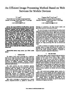
OTHR-SW Coordinate Registration method based on Sea-Land Transitions: Clutter Model Definition Fabrizio Cuccoli #1, Luca Facheris *2, Dino Giuli*3, Francesco Sermi*4 #
U.O. CNIT, c/o Dipartimento di Elettronica e Telecomunicazioni, Università di Firenze Via di Santa Marta, 3, 50139 Firenze, Italy 1
*
[email protected] 4
[email protected]
Dipartimento di Elettronica e Telecomunicazioni, Università di Firenze Via di Santa Marta, 3, 50139 Firenze, Italy 2
[email protected] 3
[email protected]
Abstract— In previous works we proposed a Coordinate Registration (CR) method of the received echo by pulsed, monostatic Over The Horizon Sky Wave Radar (OTHRsw). This method takes advantage from the a priori geo-morphological knowledge of the surveillance area (especially the coastline profile) and from the pronounced difference between the sea and land normalized backscattering coefficients. In this paper we present a model of surface clutter, its software implementation and its role in the simulation tool under development intended to recreate the complex OTHR scenario in order to analyze the performances of the proposed CR method. A brief introduction about the radar scenario is given; the main clutter model hypotheses are outlined; the adopted space-time distributions processes are motivated; the key-parameters for the model configuration are described; some examples of simulated clutter scenarios are proposed; the achieved results are finally shown.
I. INTRODUCTION By exploiting the propagation characteristics of the ionosphere, the OTHR-SW system is able to achieve a surveillance area whose extension is comparable to that of satellite constellations or airborne radar networks. Unfortunately the spatially non-homogeneous and timedependent ionospheric propagation channel leads to evident uncertainties in the received radar echo. The coordinate registration procedure is needed to associate the received data to coordinates that determine univocally its position on the Earth surface. In other terms, the purpose of any CR procedure is the georeferentiation of the radar echo. The proposed CR method relies on the localization of a sea/land transition within the radar footprint by processing the echo power profile. The method is totally independent of any external information source (e.g.: ionospheric soundings; presence of beacons/transponders or passive receivers in the surveillance area; fusion with external sensors; etc ...) [1,2]. The processing procedure required by the proposed CR method is basically a correlation between the reference binary clutter mask of the surveillance area and the power signature (in the time domain) of the returned echo.
978-2-87487-019-4 © 2010 EuMA
Fig. 1. Block diagram of the proposed OTHR-SW scenario model.
Moreover, no coherent integration is required and the timecomputational costs are really reduced.Thanks to its peculiar geomorphological structure, the East Mediterranean area (Fig. 2) offers a perfect scenario for the application of the proposed technique. Because of the difficulty in gathering real-time ionospheric information and the basic lack of surface clutter statistics in HF band, we are currently developing a composite model of the complex OTHR scenario (Fig. 2). The model includes three main blocks: radar system; ionosphere and propagation channel; clutter area and radar footprint. Its purpose is to simulate a plausible OTHR echo in different operating scenarios to be used in the correlation with the reference clutter mask of the surveillance area, in order to provide a reference performance basis of the proposed CR method.
101
30 September - 1 October 2010, Paris, France
The expected power contribution at the radar receiver, associated to the surface element ΔS, is given by the radar range equation:
Δ Prx =
Fig. 2. East-Mediterranean area with an OTHR footprint sample including a sea/land transition. Surveillance area: [600,3000] km; [50,130]°. Radar footprint: φ = 100°, δφ = 5°, β = 16°, δβ = 10°, heq = 260 km.
This paper is focused on the clutter model: the main hypotheses are outlined; the adopted space-time distribution processes are motivated; the key-parameters for the model configuration are briefly introduced; one example of simulated clutter scenario is presented and the achieved results are discussed. II. CLUTTER MODEL With the term “clutter” it is generally denoted the backscattered return from a patch of the Earth surface illuminated by a radar beam or pulse [4,5]. The development of statistical models that properly characterize radar clutter processes is critical for designing optimum algorithms for detecting targets [4] and, as in our case, to georeferentiate the received signal. In HF OTHR applications the clutter component is the dominant feature of the echo [8]: hence, the proposed CR method, based on clutter discrimination, doesn’t require high power in transmission.
Ptx G 2 λ 2
( 4π )
3
R4
σ 0 ΔS
(1)
where Ptx represents the transmitted power, G the antenna gain (the same gain is assumed in transmission and reception for sake of simplicity), λ the wavelength and R the one-way signal path. σ0 is the normalized backscattering coefficient associated to the infinitesimal radar footprint element ΔS. When this includes a sea/land patch, σ0 is evaluated proportionally to the percentage of sea/land area within the element and the respective backscattering coefficients, as shown in Fig 3. Besides the differences in σ0, sea and land clutter exhibit other features [6,7]. Both clutter processes are geographically non homogeneous (and depend on the radar grazing angle β and operating frequency f), but they have different spatial distributions. The sea clutter is highly non-stationary in time, while the land clutter should present a much more stationary behaviour in time. Under the hypothesis that a low-resolution radar is used (i.e. a resolution cell contains a large number of independent scattering structures), we can represent the EM field backscattered from a given surface patch as the superposition of the contributions from many discrete scatterers: N
E = ∑ an
I n = σ on cos φn
an = I n + jQn
Qn = σ on sin φn
n =1
(2)
Each contribution is characterized by its in-phase In and quadrature Qn components that, in turn, are functions of the normalized backscattering coefficients σon and the phases φn. Assuming a Gaussian clutter model, the probability density function (pdf) of the backscattered clutter envelope E is [4]:
2 E −( E P( E ) = e x
2
x
)
0≤E ≤∞
(3)
where x is the mean clutter power. Hence the pdf of the clutter power is expressed by: ⎛ Pσ 0
1 −⎜ P( Pσ 0 ) = e ⎝ x
⎞ x ⎟⎠
0 ≤ Pσ 0 ≤ ∞
(4)
where Pσ0 is the clutter power contribution of the surface element ΔS characterized by the backscattering coefficient σ0. It is then assumed that clutter is spatially stationary and isotropic, with a Gaussian spatial correlation coefficient:
ρ (r ) = e Fig. 3. OTHR footprint sample with coastline profile: evaluation of the normalized backscattering coefficient σ0 relative to the surface element ∆S.
− ln(10) ⎛⎜ r ⎞⎟ ⎝ rd ⎠
2
(5)
where r is the radial distance between the cell centre and rd is the decorrelation distance.
102
Fig. 4. Zoom of the OTHR footprint sample presented in Fig. 1, and segmentation of the geographic area in squared surface elements ΔS. The algorithm evaluates of the backscattering coefficient for every patch.
We define the instantaneous power Pσ0(t) corresponding to the surface element ΔS with σ0 as “Instantaneous Surface Power Contribution” (ISPC). The implemented algorithm generates a matrix which columns and rows are respectively associated with the surface components (patch) of the radar footprint and with the pertinent time samples. In the presented clutter model the decorrelation time Tdc is assumed proportional to the radar transmitted pulse length by a scalable factor, hence the temporal correlation of ISPC depend on the operating radar bandwidth B. III. SIMULATION SETUP AND RESULTS The developed algorithm asks the user to define the OTHR geographic scenario in terms of radar site location and surveillance area extent. In this work we assumed the east Mediterranean coastline whose reference map together with some operating parameters is presented in Fig. 2. Then, accordingly to several user-driven parameters (such as the radar azimuth and elevation angles φ and β, the 3dB beamwidths in azimuth and elevation δφ and δβ, and the equivalent ionospheric reflection height heq), it shows the radar footprint position.
Fig. 5. Two consecutive instantaneous clutter realization simulated for a squared (half sea, half land) surface partitioned into 2500 squared patches.
After sketching the zoom of the footprint, the algorithm operates a regular segmentation of footprint interested geographic area, based on the user-selected parameter ΔS, and evaluates the backscattering coefficients σ0 of every surface patch (Fig. 4). These data are then employed as amplitude entries for the statistical simulation of the clutter process: the Gaussian stationary and isotropic spatial correlation is imposed, while the time correlation is taken as inversely proportional to the operating bandwidth B. In the proposed simulation the decorrelation distance is posed equivalent to 4 cells, namely according to the data shown in Fig. 4, to about 105 km. The clutter band is set to one third of the radar bandwidth. The presented results are referred to a 1 ms transmitted pulse. The algorithm final output is structured as a rectangular matrix of complex values (in-phase and quadrature components). Each row represent a clutter instantaneous realization of the considered surface (Fig. 5), while each column shows the time behaviour of amplitude and phase clutter for a specific patch (Fig. 6). IV. CONSIDERATIONS AND CONCLUSIONS We presented a statistical surface clutter model and its implementation for an HF OTHRsw system applications. The clutter model is intended to be part of a software (currently under development) whose purpose is to simulate the entire OTHR scenario, in order to generate the echo received by the radar operating with a constant pointing direction. With the assistance of this simulated echo, we aim at analysing the performance of the CR method (outlined in [1,2,3]) based on the sea/land transition identification. The main hypotheses on which the clutter model is based are: the low-resolution nature of OTHR-SW system (that leads to a Gaussian statistic of clutter); the stationary and isotropic structure of the surface clutter spatial distribution; the radarimposed temporal correlation of the clutter process. Moreover, some consideration are needed about the amplitude contribution of the various surface cells. In a real scenario, every surface patch is characterized by a specific value of the backscattering coefficient that depends on seastate conditions [8] for water-patches, on several different aspects (terrain slope and compositions [9], presence of discrete λ/2-comparable scatterers, etc...) for land-patches and on a combination of the two for mixed-nature patches. So far, the proposed model makes use of only two backscattering coefficient values (one for sea and the other for land). Note that this assumption is not a limitation of the model that could in any way affect the CR method testing procedure. Once the feasibility of the method is confirmed, every sudden irregularity of the backscattering coefficient could be eventually employed as a geographically known reference for the CR process. According to [5], the sea specific backscattering coefficient is assumed to be in the order of -27dB/km2, independently of sea-state conditions. σ0 for land areas is a model parameter, set to -37dB/km2 in the presented results. For mixed sea-land patches the resulting σ0 is evaluated as reported in Fig. 3.
103
Fig. 6. Temporal characteristic (250 samples) of clutter (amplitude and phase are plotted with a continuous line and dots, respectively) relative to the seapatch element 11 of the proposed simulation scenario. Simulation duration: 10 ms; sample period: 0.04 ms.
Based on an even more simplified model of the OTHR-SW scenario, we concluded in a previous work that a difference gradient ∆σ0 of about 7 dB/km2 between sea and land specific backscattering coefficients, should reasonably guarantee the correct application of the proposed CR method, when the minimum clutter-to-noise (CNR) condition is satisfied [1]. The objective of the new OTHR-SW scenario model is 1) to confirm the validity of the land/sea transition CR approach and 2) to refine the quantitative estimation of minimum CNR and ∆σ0 requested for the method applicability. ACKNOWLEDGMENT The authors would like to thank Luca Capannesi for his technical support. REFERENCES [1]
[2]
[3]
[4] [5] [6] [7] [8] [9]
F. Cuccoli, L. Facheris, D. Giuli, and F. Sermi, “Over the horizon skywave radar: Coordinate registration by sea-land transitions identification”, Progress in Electromagnetics Research Symposium, 2009. F. Cuccoli, L. Facheris, D. Giuli, and F. Sermi, “Over The Horizon Sky-Wave Radar: Simulation Tool for Coordinate Registration Method based on Sea-Land Transitions Identification”, EuRAD Symposium 2009, Rome. F. Cuccoli, L. Facheris, D. Giuli, and F. Sermi, “Sea-Land Transitions Identification for Coordinate Registration of Over The Horizon SkyWave Radar: numerical model for performance analysis.”, IRS Symposium 2010, Vilnius. K. D. Ward, R. J. A. Tough, and S. Watts, “Sea Clutter: Scattering, the K Distribution and Radar Performance”. The Institution of Engineering and Technology, 2006. M. Skolnik, “Radar Handbook”, sec ed. McGraw-Hill, 1990, ch. 24. G. C. Sarno - "Modelling of Radar Clutter" - IEE Colloquium on: Computer Modeling and Simulation of Radar Systems (1993). R. H. Khan, “Ocean-Clutter Model For High-Frequency Radar,” IEEE Journal of Oceanic Engineering Vol.16 No.2, pp. 181–188, 1991. D. E. Barrick, “Remote Sensing of Sea State by Radar,” OCEANS, vol. 4, pp. 186–192, Sept. 1972. C.A. Darrah, D. W. Luke - "Site-Specific Clutter Modeling Using DMA Digital Terrain Elevation data (DTED), Digital Features Analysis Data (DFAD), and Lincoln Laboratory Five Frequency Clutter Amplitude Data" - Proceedings of the 1996 IEEE National Radar Conference.
104